Great Divide (NOBO) - Day #42 Ram Falls Campground, AB to Blackstone River, AB
Great Divide (NOBO) - Day #42
July 11 2022
Ram Falls Campground, AB to Blackstone River, AB - 62 Miles
Start 9:09 AM Finish 6:45 PM
Total Duration 9:36
Moving Time 6:16
Stopped Time 3:20
Ascent 4,639 Feet
Descent 5,938 Feet
Tour Total 3,046 Miles
Details at: https://ridewithgps.com/trips/96322018
It got really cold last night and I had to completely envelop myself in my sleeping bag and liner. I slept for nine hours and didn’t get up once. It was freezing and I tried to stay as warm as possible. I don’t know what made it so cold. I was at 5320’ elevation. The motorist from Canmore had told me this area experienced huge temperature swings. I slept in this morning because I didn’t want to get up. It was too cold. There was no condensation in the tent. The pack-up was slow and I enjoyed sliced pears for breakfast. A chipmunk was watching my every move, and waiting to grab the tortilla crumbs. I was down to a half a jar of peanut butter, and I disposed all my trash. I rolled out without paying, and it was logged as my second Canadian campground sneak in. My lodging expenses north of the border were slowly starting to even out.
I rode back out onto the gravel highway and there was already a headwind. This was confirmed by the fully inflated wind sock at the small airfield across the road. The wind was out of the west and fortunately I would soon be turning north. There wasn’t a single cloud in the sky and the sun had been up for hours. The mountains were getting taller to the north which included snow patches. A dump truck towing another dump truck-sized trailer passed me going south, kicking up an immense dust cloud.
I stopped to adjust my buff and to slip the wires for my earbuds underneath it. This made it easier to quickly lift the buff over my face. Three large gravel trucks then passed me. It was shaping up to be a dusty morning. Another gravel truck passed me going north and then took a left on a turn-off. Hopefully they would all be making this turn. The dust was really bad, and also dangerous in terms of visibility.
I was wearing my socks, leg-warmers, and jacket and started climbing a big, long, steep hill. I stopped midway to unzip. I thought about stripping down, but finally reached the top and was glad to have the extra layer on the cool descent. Then I began climbing again. I got hot and eventually came to the long-awaited yellow sign showing a truck on a downward sloping triangle wedge. I rode down the hill and crossed Cripple Creek. I then started another uphill. My poor legs were sore and tired. I rode up and then down to cross Side Creek, and then back up the other side to a switchback.
The next hill just kept going. According to the elevation profile, it would be the biggest one of the day. I couldn’t handle the heat anymore, and stopped to remove my socks, leg-warmers, and jacket. I added my arm protectors and blew off the sunscreen. Finally I got to the downhill sign. On the descent I passed a motorist parked in the oncoming. He was collecting logs. A motorcycle passed going south, and then I crossed over the North Ram River. I came to an intersection with North Fork Road.
I stopped to flip my map panel. I was now on ACA Canada Map Section A, the last section of the tour. Nordegg was eighteen miles and two climbs away. I kept pedaling. There was nothing but fir trees and the occasional Aspen. A white pick-up truck passed me going south. There was still not a single cloud in the sky.
I had another long climb, and part of it was really steep. I was passed in both directions by motorists towing RV’s. I stopped up top at the downhill sign for a drink of water. I then enjoyed a huge long downhill and crossed Smith Creek. I rode up over a bump and then had another downhill and crossed the north Saskatchewan River on a three span steel truss bridge.
On the other side of the bridge, alongside the river, I noticed two dividers, Steve and Eloise from Ottawa. They had started in Jasper and were going all the way to Antelope Wells. It was their fifth day out. They promised restaurants, beer, and pie in Nordegg, and said there were plenty of good spots to camp north of there. They also said that I had a massive climb uphill out of the river valley. I started the climb, and the gravel was really thick. The passing motorists were taking the best paths, and I decided to make them yield.
I was climbing up a steep section and was riding the only worn path through the piles of loose gravel, right down the center of the road. I could hear a motor vehicle approaching from behind me and there was plenty of space for them to pass me to the right. They honked. Never honk at a cyclist. Me being a New Yorker, I quickly threw down the middle finger. He slowly passed and rolled down his window and said, ‘I just wanted to let you know that I was there’. I apologized for being a New Yorker. Never honk at a cyclist. We know you’re there. Your vehicles and tires are loud. Even if we have music blasting through our earbuds, we can hear you.
It was a steep uphill with loose gravel washboards. Swarms of bees and bugs were in my face, and my iPod wasn’t working. I finally made it to the mellow grade up top. There was a large scraping machine leveling the gravel on the road. They had scraped down to the dirt and left a pile of gravel down the center of the road. I enjoyed the dirt, and only one motorist passed me. I stayed near the center and made them go around me to the right. I finally caught up with the machine and was then given a narrow margin on the right side. The bugs and bees swarming around my face were driving me out of my mind. A sprayer truck came down the road probably discharging nasty carcinogenic chemicals. And then, Woohoo! There were utility poles alongside the road. I was getting close to restaurants, beer, pie, and Internet.
The grade mellowed out, and I passed the sprayer. There was a huge range in front of me to the north, and I and figured Highway 11 and Nordegg would be in the valley. I came to the intersection with Highway 11 and took a right. Nordegg was a mile and a half off route. I was on pavement and had a nice wide shoulder. There were billboards for restaurants in town.
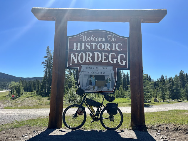
I stopped at the Nordic Lodge Axe & Shovel Restaurant. I sat down at a table next to an outlet and plugged in my devices. I asked for the WiFi password and was given two sixty minute tickets, one for each device. I ordered two bacon cheeseburgers and two Caesar salads, along with five $7 bottles of Stella. The beer selection was horrible and the prices were outrageous. I was in the middle of nowhere and had no choice. After feeding myself, uploading the past two days’ reports, posting my social media, charging my devices, and cleaning myself in the bathroom, I headed out. I heard from Andre and Gerda whom had finished their tour in Banff.
I stopped at Fas Gas for some breakfast provisions and snacks. I then went to the liquor store and got myself a six-pack of Stella for the campground. Once again, the beer selection was poor and the prices were high. The USA section was trumping Canada on the beer. My GPS had died while I was eating, which made no sense. There had been plenty of power last night before I began recharging it. I was unable to restart it from my charger and found a wall outlet behind the Shell station. It was frustrating to be delayed by an electronic device, and I almost switched over to the Cyclemeter app on my iPhone. Perhaps the cold weather had affected my iPad battery and Wahoo. It might have been below freezing last night. I did some report editing while I waited, and then it was time to roll. I got back out on Highway 11 and had a strong headwind as I traveled west to get back to the route.
I took a right back onto Alberta 734 North, aka Forestry Trunk Road. There were the same signs about it being an unimproved road and no services for next 125 km. My map indicated there were no services for the next seventy-five miles. I was back on gravel and headed north. I passed a lot of people camping and recreating along the road. A father was teaching his young son how to ride a kid-sized motorcycle. There was a lot of climbing and the sun was strong and hot. I was worried about my beer getting warm, and charging cables were all running over my handlebars. According to the elevation profile the first climb would be the hardest, and it wouldn’t be steep.
After twenty miles I came to the Blackstone River. I found a great spot to pitch my tent, and cooled down my beer in the ice-cold river. After the sun went behind the trees I enjoyed my spot, while eating pretzels, drinking Stella, and editing this report.
 |
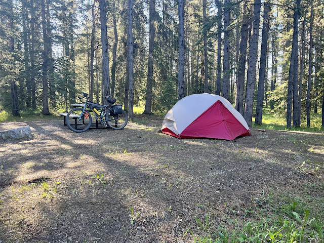
| Ram Falls Campground, site #7 |
 |
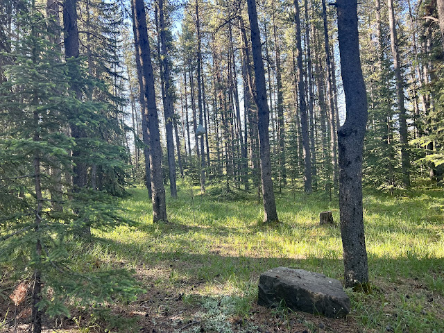
| Can you spot my bear bag? |
 |
| Alberta 734 North, aka Forestry Trunk Road |
 |
| Forestry Trunk Road Bridge over the North Saskatchewan River |
 |
| North Saskatchewan River |
 |
| Well deserved beer stop |
 |
| Map/Elevation Profile |


Comments
Post a Comment