Great Divide (NOBO) - Day #41 Red Deer River Campground North, AB to Ram Falls Campground, AB
Great Divide (NOBO) - Day #41
July 10, 2022
Red Deer River Campground North, AB to Ram Falls Campground, AB - 77 Miles
Start 8:14 AM Finish 6:29 PM
Total Duration 10:15
Moving Time 8:50
Stopped Time 1:24
Ascent 6,267 Feet
Descent 5,676 Feet
Tour Total 2,984 Miles
Details at: https://ridewithgps.com/trips/96212913
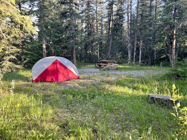
I slept well in in campsite number seven at Red Deer River Campground North. The sun has been setting really late and rising early. The days have been long. There was still plenty of light when I went to bed last night around nine. I was tired but the light effected me and I couldn’t fall asleep. I was a couple hundred feet from the Red Deer River and could hear the murmur of people and music from somewhere. Every once in a while I would hear the rumble of a car on the gravel highway. I eventually drifted asleep. It was warm and I didn’t need to zip my sleeping bag. It got cold in the middle of the night, and I got up a couple of times. I woke up at 5:30 AM. There was plenty of light, but I was able to roll over and get another hour of sleep. I took my time packing and enjoyed a can of peaches that I had transported from Helena. There was condensation in the tent. It was chilly and I was wearing my socks, leg-warmers, and jacket. My fingertips were cold. Last night was the first time that I didn’t have to pay for somewhere to sleep in Canada. When I left the campground I checked carefully, and the entrance was locked with a padlock. Unless there was a another way in, the other campers had a key. It was logged as a campsite sneak-in.
The ride began with a climb, and I was in the shade. I could see the sun on a switch-back ahead. I climbed up out of the Elk River Valley which for some reason was known as Hunter Valley. I passed the turn-off for Sundre and crossed a creek. I was on Alberta 734, aka Forest Trunk Road, heading north and passed signs warning ‘Flood Hazards Ahead' 'Drive Carefully’, ‘No Winter Road Maintenance’, ‘Unimproved Road' 'No Services Next 120 km'. I was in the middle of nowhere. Was yesterday’s food truck a mirage? The guy yesterday from Calgary had told me that it was Calgary Stampede this weekend. Everybody in Alberta was supposedly there. The air was cold this morning, but the sun and climbing were effective. I stopped to unzip and open my jacket.
While I cycle, I listen to music the entire ride. I have 20 GB of WFMU program files on my iPod Nano. I’ve been shuffling programs by 'The Duane Train', '$mall ¢hange', 'Sheila B', 'Evan Funk Davies', and 'Todd-o-phonic Todd'. A northbound motorist passed me and I was riding in the oncoming lane. I passed a burned area, and the lower portion was clear-cut. I had a nice downhill and at the bottom there was a turn where I noticed the remnants of a car crash. I saw broken windshield glass and spilled oil.
I continued down a big long hill and reached a valley filled with grass and shrubs. The hill on the other side of the valley had been clear-cut and everywhere else was full of fir trees and Aspen. I pulled over to fold my map, and was now on ACA Canada Map Section B. I crossed Bridgland Creek.
Yesterday the water from of one of my plastic bottles had tasted funky. I had dumped it out and replaced what was left at the food truck. My seat post bag has two small tears in it from where the canned food had been rubbing up against it. I no longer have complete confidence in my air pump. The cap was loose when Sholto used it at Peter Lougheed Provincial Park. It didn’t feel right when I used it in Banff, and I wasn’t able to get high pressure. I was wondering if dust or debris got in there.
I was startled by a group of six wild horses in the middle of the road. And then I saw a pair of deer, which my stupid phone dictated that as ‘Kennesaw Paramvir’. The food truck lady had told me that there was a lot of truck traffic during the week, and I was benefiting from it being a weekend.
I was looking at my maps last night and realized that Jasper was directly above Banff. They were connected by a river valley and highway. The ACA route meandered way to the east, and then re-entered the stunning mountain ranges to the north. I was currently on a another wide semi-circle headed east. On the map it looked like a distorted face, with a wrinkled chin, a bumpy nose and either horns or
lumps on the forehead.
There were gray clouds to the north, and I was riding downstream along the James River. The gravel was really thick here. Three pick-up trucks towing trailers passed me kicking up billowing clouds of dust. I passed a gravel pit on the left and then crossed a steel truss bridge across the James River. A pick-up truck towing a trailer passed me going north.
I passed James Wilson Provincial Recreation Area. There were two pick-up trucks pulling trailers that passed me going north as another passed me going south. I crossed over another steel truss bridge back over the James River. The motor traffic was light but consistent. A lot of people camp along this road. I even saw a ‘Watch Your Speed’ warning device. I was used to having these roads to myself, and I had to remember to stay over to the right.
The sun went behind the clouds and I passed gas pipeline. A deer ran across the road and then I came to the turn-off for Sondre. I continued straight towards Nordegg. This intersection corresponded with the bump on the nose on the grotesque figure I was seeing on the map. It was 10:49 AM and I had traveled twenty-seven miles. I was eighty-six miles from Nordegg.
I crossed Bread Creek and continued northwest towards the eye on the map, and then towards the forehead. It would be thirteen miles from the tip of the nose to the tip of the second horn. The sun was trying to come out and my shadow emerged and then disappeared. A pick-up truck with a Canadian flag in the rear window passed me.
A pick-up truck towing a horse trailer passed me going south. I crossed Teepee Pole Creek. Three ATVs completely splattered with wet mud passed me going north. I climbed to the top of the next hill, and zipped up my jacket before bombing down the other side. I stopped and talked to south-bound divider Dallas from Los Alamos, New Mexico. He was going from Jasper to Antelope Wells, and was riding an all carbon fiber Salsa Cutthroat. He was traveling with five days worth of food and hadn’t stopped in Nordegg or Robb. He had stayed in the campground where I was headed tonight, and mentioned that the water would need to be filtered. He told me that the last stretch into Jasper was single track with some stream crossings.
I came to the intersection with 591 towards Caroline. I stayed left and remained on 734 towards Nordegg. I was now at the tip of the second horn on the face that I could see on the map. Ram Falls, my destination for the day, was thirty-six miles away. Nordegg was seventy-three miles.
I passed a limestone quarry to my right, with a giant factory-sized white tent. Two motorists passed me going south. I had a long climb curving up along a ridge and then I rode along the Clearwater River. I came to an open range with cattle on both sides
I reached Seven-Mile Provincial Recreation Area, and pulled in to pump and filter some drinking water. I ate a snack consisting of peanut butter and crumpled stale corn tortillas, and flipped my map section. Back out on the road, the wind had really picked up and I was riding straight into it. There was a large clear-cut to my right that went on for miles. By 3 PM I had ridden fifty-four miles. I had another large climb in front of me, and finally pulled over to remove my leg-warmers, socks, and jacket. I didn’t bother to add the arm protectors or sunscreen.
I reached the top of the climb by 4 PM and then it was downhill time. On the way down I came to the intersection with Road 752. I was nineteen miles from my destination and fifty-six miles from Nordegg. At the bottom of the hill was a wide valley with an open range. I noticed motorists camping with RV’s in the corner of the clearing. Out in the pasture were horses and cattle.
I crossed over Radiant Creek and still had a strong headwind. I finally came to Elk Creek Provincial Recreational Area. I was eleven miles from my destination and it was 4:50 PM. Then I passed Elk Creek Fish Pond Recreational Area.
After a few miles I crossed over Elk Creek and climbed up another large bend. I had to grumble about how there were people camping in RV’s all alongside this road, yet I would probably get charged tonight and reamed about how I hung my food.
After the climb I had a nice downhill where I crossed the South Ram River. After a short climb out of the narrow valley I entered Ram Falls Provincial Recreation Area. There were no envelopes at the pay area and a sign said that the host was off-duty. I rode in and selected site number eleven. After I set up my tent, I went and pumped and filtered water. For dinner I enjoyed a bag of Fillo’s Puerto Rican pink beans and then a second bag of Aplenty Jalapeño refried beans. I mixed handfuls of stale corn tortilla crumbs with both servings. I set I up my bear line and edited this report from the picnic table as flies and mosquitoes drove me crazy.
 |
| Red Deer River Campground North campsite #7 |
 |
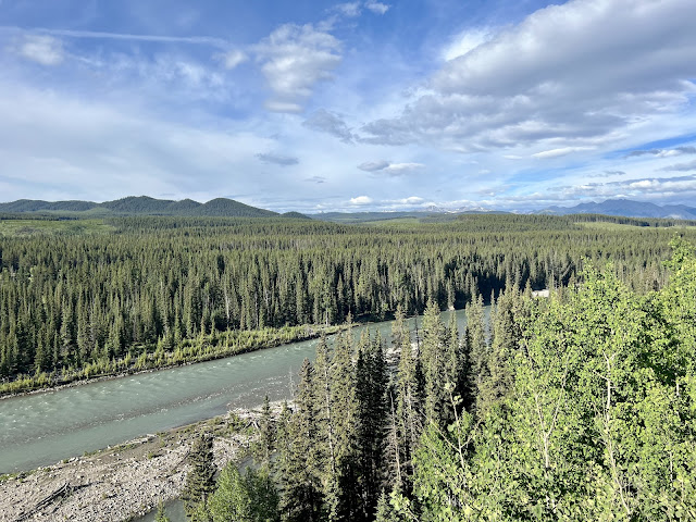
| Red Deer River |
 |
| Making progress |
 |
| It looks like a face, right? |
 |
| Elk Creek |
 |
| Steel truss bridge over Ram River |
 |
| Map/Elevation Profile |


Comments
Post a Comment