Great Divide (NOBO) - Day #40 Canmore, AB to Red Deer River Campground North, AB
Great Divide (NOBO) - Day #40
July 9 2022
Canmore, AB to Red Deer River Campground North, AB - 89 Miles
Start 7:37 AM Finish 5:50 PM
Total Duration 10:13
Moving Time 7:55
Stopped Time 2:18
Ascent 5,219 Feet
Descent 4,783 Feet
Tour Total 2,907 Miles
Details at: https://ridewithgps.com/trips/96212493
I slept incredibly well last night in a queen bed at the Lamphouse Hotel in room number three. Last evening after the brewery I peddled over to the Party Hostel in the center of Canmore. The door lock was broken and a grumpy old man told me that bikes weren’t allowed inside. The manager repeated that I had to leave it outside. When I replied that I didn’t have a lock, I was reassured that no one would steal it. Another cyclist said that I could share his cable lock and gave me his combination. I stripped off all of my bags and brought everything up to the second floor. My room was cramped and there was a couple giggling behind a curtain on a lower bunk. I had an upper bunk on a cheap rickety steel frame. The room was hot, and it was still early. The loud music wouldn’t start until later. I couldn’t do it. I grabbed all of my bags and left. Out front I met southbound cyclist Graeme who also had a reservation at the Party Hostel. We decided to split a room at the Lamphouse down the street. I reattached all of my bags and, fingers crossed, nothing got lost in the shuffle. Graeme went out to eat while I got myself a margarita and some Fritos. Graeme was from Albuquerque and had started in Jasper. He had taken the Ice Fields Highway south and recommended it. He told me that I was headed into remote territory.
This morning I woke up at 6 AM and tried to roll over and go back to sleep. Graeme got up, and I decided that it was time to get going. He would be taking an off-day today. We said our goodbyes and I rode off. I stopped at an Esso station on the edge of town, where I purchased a package of Vachon Granny’s Tarts, Tim Hortons Ice Cap Original, and a Simply Orange juice. I rode out of town on Highway 1A aka the Bow Valley Trail. My map indicated that I would have limited services for the next ninety-one miles. It was 52°F and I was wearing my jacket, leg-warmers, and socks. I rode by the ginormous Bay Mag plant. There was a lot of motor traffic and my rear light and radar were on.
After ten miles I rode through the hamlet of Exshaw, 'the heart of the valley'. I passed the humongous Lafarge plant. Exshaw had a gas station and a post office, and I kept going. Then I passed the large Gremont Exshaw plant. As I traveled north-east I left the large impressive mountain peaks. The land began to flatten out and transitioned to rolling hills. Highway 1A had two lanes of motor traffic and followed the Bow River. Four-lane Canada Highway 1 was on the other side of the river. I was passed by two south-bounders who were lightly loaded, and I doubted they were self-supported dividers.
Road signs warned of sharp shoulders which were a little terrifying with the fast moving motor traffic. I stopped for a moment to turn around and admire the astounding mountain range behind me. They were incredible! I later pulled over to read a plaque about the McDougal Memorial United Church, formerly the Morleyville Historic Mission.
I stopped at the turn-off to Morley to remove my leg-warmers, socks, and jacket, and was quickly enveloped by a cloud of mosquitoes, all trying to attach themselves to me. My fatigued fingers had difficulty with the zippers, removing socks, and even the pannier strap buckles. It sometimes took forever to fasten them. Trying to balance on one foot as I removed one side at a time, I was doing the shaky dance trying keep the mosquitoes away. I almost gave up halfway through. Graeme had warned me they would be bad.
I was passed by a southbound divider. I rode by Ghost Reservoir and there were dozens of sailboats anchored out in the water. Somebody was water skiing under the bridge as I was about to cross it. I could the ginormous dam ahead. I entered Rockyview County and noticed a housing community to my right, with tightly-packed newly constructed summer houses. Banners promoted ‘Cottage Club at Ghost Lake. Gated Community. Potable water year round’.
I stopped at Ghost Station and the radio was blasting Lynyrd Skynyrd’s ‘Sweet Home Alabama’. The selections were slim, and I got myself a tasteless egg salad sandwich, a stale turkey Swiss sandwich, a bag of Planters Honey Roasted Peanuts, and a Pink Gatorade. After my snack break I took a left on Highway 40, aka Forestry Trunk Road. Nordegg was a hundred and sixty three miles to the north, whereas Calgary was only thirty four miles to the east.
I passed a pair of southbound male and female dividers. I was still on a pavement and there was no longer a white line. There was a sharp steep drop-off to the side of the road with moderate to heavy motor traffic. The route dog-legged north and then back west, bringing the distant magnificent mountains back into view.
The wind was out in the west and I had been enjoying a tail wind and making good time. After the turn, the wind was in my face and it would be slow going for the next fifteen miles. I rode through Waiparous Village and there were no services. I had a nice drop and crossed Waiparous Creek. The Aspen trees here were scragglier than down south. I rode through a grass pasture and passed a herd of cattle.
I came to the ankle part of the route's dog-leg and began heading north. After a few miles the pavement ended and I was on gravel. The road was still wide and the surface was decent. Motor vehicles passed me and kicked up clouds of dust. Guns were being fired in the distance. I came to Waiparous Campground, which had been my original destination for the day. I had ridden sixty miles and it was 1:30 PM. I crossed back over Waiparous Creek, and then stopped at North Ghost Recreation Area to flip my map. A motorist stopped to ask me if I was lost.
I climbed up over a pass and entered the Red Deer River Watershed. Eventually I came to the intersection with Howard Creek/Salisbury Road and now found myself on County Road 734, aka Forestry Trunk Road. Cattle guards in this part of Canada were called Texas Gates. I entered an open range. The motor traffic had gotten sparse, and I stopped to turn off my rear light and radar.
I passed by Burnt Timber Campground and crossed Burnt Timber Creek. I climbed up another hill and then crossed McCue Creek after the downhill. I came to the Red Deer River Campground and crossed Fisher Creek. My map had indicted a possible store and/or restaurant at Sunset Guiding and Outfitting, a luxury resort three miles off route. I had Googled it, and was uncertain what services they offered. Because I was still a hundred and twenty miles from the next services, I was planning and hoping to find food rather than eat what I had packed.
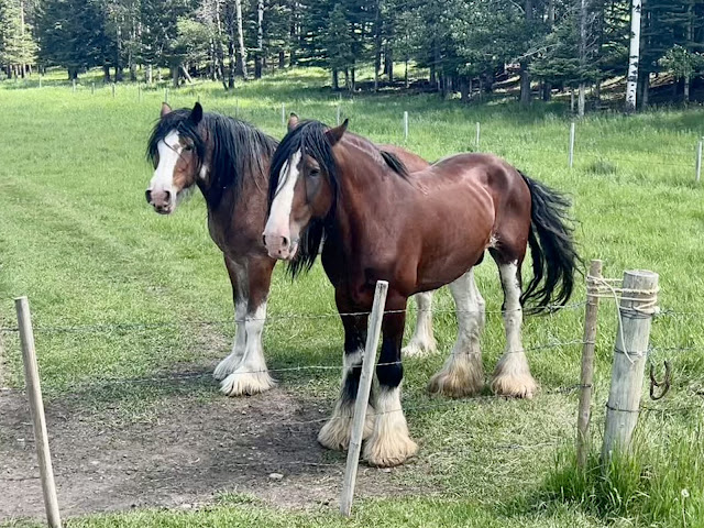
At the intersection of the turn-off I found Grillz Weenie Wagon, a food truck run by a friendly woman from Calgary. I was literally in the middle of nowhere. That said, there were nearby campgrounds and lodges. I ordered a cheeseburger and fries along with several Cokes and iced teas. I talked with the woman while she cooked my food, and enjoyed the bumping music she was playing. A friendly couple from Calgary stopped to chat. They had a nearby summer place, and told me that I wouldn’t find much at the resort. I was also warned that I had a lot of climbing to get to Nordegg. I had seen a group of horses earlier, and was told that they were wild. Later I talked with three younger First People. Everyone was amazed that I had ridden so far, and that I was traveling so light.
After my meal I crossed the Red Deer River on a single lane steel truss bridge with a wooden deck. The gate to the Red Deer River Campground North was closed and I rode around it. There were motorists at campsites inside, and I selected site number seven near the river. I set up my tent and hung my bear bag. I sat at the picnic table and edited this report.
 |
| Highway 1A aka the Bow Valley Trail |
 |
| The Canadian Rockies back to the west |
 |
| McDougal Memorial United Church, formerly the Morleyville Historic Mission. |
 |
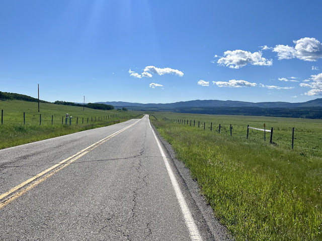
| Nordegg here I come! |
 |
| Grillz Weenie Wagon - out in the middle of nowhere. Was this a mirage? |
 |
| Map/Elevation Profile |


Comments
Post a Comment