Great Divide (NOBO) - Day #9 Abiquiu, NM to Horca, CO
Great Divide (NOBO) - Day #9
June 4, 2022
Abiquiu, NM to Horca, CO - 85 Miles
Start 6:26 AM Finish 6:28 PM
Total Duration 12:02
Moving Time 8:41
Stopped Time 3:21
Ascent 6656 Feet
Descent 3920 Feet
Tour Total 662 Miles
Details at: https://ridewithgps.com/trips/92388171
I slept great last night in my tiny hut at Goldie’s Retreat on the River in Abiquiu. I had a bed and it was comfy. I slept in my silk sleeping bag liner with my inflatable pillow. There were a few blankets that I spread over top myself. The bugs had driven me crazy last night sitting out at the picnic table. They were all over my screen, and I reached a point where I couldn’t stand it anymore. My reports were caught up, and all of my devices (except for my rear light) were fully charged. I was at level one, and my rear spokes had been inspected and tightened. I woke up with the first light and it was time to get going. Andrew and Kim were up by the time I left. I started back up the hill on US 84 towards Abiquiu Lake. I was wearing my jacket and leg-warmers. My rear light and radar were on and working, and I had my sideview mirror clipped to my sunglasses. I would have pavement all the way to my destination.
I passed a road sign that said, ‘Tierra Amarilla 45 miles and Chama 57 miles’. I had many miles of cycling before I’d be stopping. Andrew and Kim had told me that were services in Chama. They also told me that water from the Chama River was pumped over the divide to the Colorado River to make up for water that’s been diverted somewhere else.
I came to a brand new section of asphalt and I had a six inch shoulder. The hill wasn’t bad. I was riding in the shade and there were stunning views. The traffic was light and the grade wasn’t steep. I warmed up quickly on the climb. I got to the intersection of US Highway 96 and the lake was in front of me. I was now on US 84 headed north. The winds today were forecast out of the east.
A pick-up truck with four mountain bikes in the back passed me going the other direction. I rode by a phenomenal rock face that was gorgeously sculpted. Then I rode through a painted valley with gray and crimson bands. I passed by the entrance to a ghost ranch and then crossed over a bridge where I could see a small brown stream below.
Tierra Amarilla was now thirty miles ahead and Chama was fort-two. I left the Pedra Lumbray Land Grant Area. I had noticed signs for it yesterday as well. I then entered the San Joaquin Rio Chama Land Grant Area. I came to an area where there were large arches carved into the rock face and then I passed Echo amphitheater, an enormous natural band shell cut into the rock. I wondered what the acoustics were like.
As I was climbing up towards another ridge, a motorist from the other direction slowed down quickly rolled down his window to tell me that there was a coyote in the road up ahead. I pulled out my pepper spray and clipped it to my map. I continued forward, and as I rounded the next corner I saw him scrambling into the bushes.
At the twenty mile mark I pulled over next to a guard rail to do my wardrobe change. I lathered myself with sunscreen and guzzled some water. By 9:30AM I had reached the top of the ridge. I was at 7,700’ elevation and I had ridden twenty-five miles.
I came to the junction with State Highway 115. Tierra Amarilla was seventeen miles ahead and Chama was thirty-two miles. I left the Carson National Forest. I came to the small town of Cebolla, no population listed. I stopped at a Mustang station and walked through the door. I was surprised to find myself within the El Cuerno Cantina, a small old western bar with $1 bills plastered to very surface. Through another door was a small convenience store where I purchased a canned espresso drink, an orange juice, and a Rice Crispy treat. I sat at the bar and talked to the bartender, while I ate my breakfast. We chatted about everything, and I could tell that he didn’t want me to leave. In fact, he followed me outside to my bike. He said that after Chama I would be climbing, but then afterwards would be an incredible downhill.
I passed the junction for State Highway 162 and I got an notification that my radar and rear light had a low battery. I pulled into Tierra Amarilla and the mountains in the distance were enormous. I stopped at a Mustang station for a bottle of Coke and a bag of cashews. I plugged my rear light to my battery pack to recharge it, and stuck the power pack in my rear left pannier. It continued to charge while I cycled. In addition to the Mustang there was a Chevron, Family Dollar, hardware store, post office, and some New Mexico DOT facilities.
I crossed over the Brazos River and noticed plenty of brown flowing water below. Brand new asphalt appeared on the highway and there were no traffic markings. This area was thick with prairie dogs. Their tunnel entrances lined the side of the highway, and the friendly beasts scrambled to and fro as I rode by.
When I started this morning the sky had been clear. By 12:30 PM it was dotted with white puffy clouds. Finally I entered Chama, population 1,199 and elevation 7,800’. I went to the Elk Horn Cafe, and grabbed a table next to a wall outlet. I began charging my devices while I ordered a Chama burger with fries, along with a few bottles of Corona.
Back out on the road I continued through Chama. There were many businesses, restaurants, and hotels. This was the most affluent area that I’d noticed in New Mexico. I crossed the Chama River which had a nice flow, and I passed the small narrow gauge Cumbres and Toltec scenic railroad.
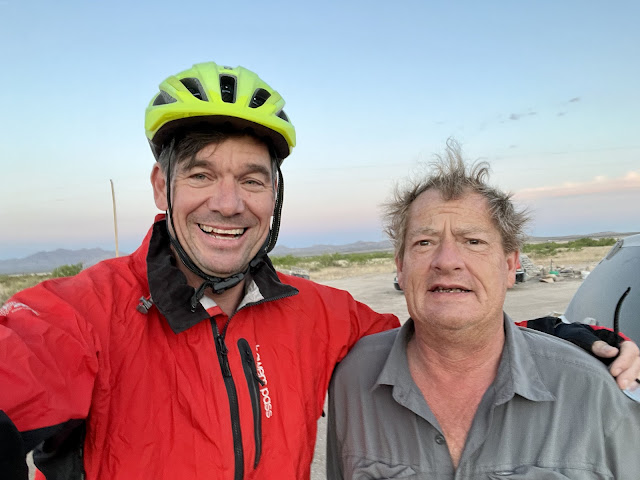
I was reading an information sign and a woman walked up to me and asked if I was doing the Divide. We started talking and then her husband appeared, wearing a Koocanusa T-shirt. I asked where they were from, and they replied Libby, MT. Long story short I had met Susie and Greg when I rode the Northern Tier in 2019. They were friends with Team Spokane. We took a selfie to send to our friends. What a small world! Greg would be cycling parts of the divide while Susie provided motor vehicle support.
Out of Chama I began climbing, and soon I noticed Aspen trees. I just kept climbing. It was a mellow grade and there were beautiful views of green grass and trees. I still had a pleasant tail wind, and it was like a gentle hand pushing me up the pass.
I passed a sign that said I was leaving New Mexico, Hasta la Vista! It was sad to say goodbye. New Mexico was now one of my favorite states. I was headed up the Cumbres pass. I crossed into Colorado, did my border documentation, and entered Archuleta County. I was now on los Caminos Antigos scenic byway and also in the Sangre de Christo National Heritage area.
I was at 9,200’ elevation and could once again see where I was on my ACA paper map. I was about six miles from being back on route. I stopped to read some information signs about the history of the area, and then, after some more climbing, crossed into Conejos county. I got to the summit of 10,022’ Cumbres pass at 4:30 PM. I had pedaled seventy miles. There were three sets of narrow gauge railroad tracks up at the summit. After a few miles down the road I was back on the route. Hopefully there wouldn’t be any more detours on this tour.
I circled around a small typical Colorado alpine town and then began climbing La Manga pass. I was surrounded by gurgling streams and water scarcity was no longer a problem. I made it to the summit of 10,230’ La Manga Pass and it was 5:22 PM. I had ridden 77 miles. I went screaming down the backside into a narrow valley, and entered the small town of Horca.
The only business I noticed was the Red Bear Welcome Center, and it was in the process of being renovated. I asked if there was a store in town and they replied that there wasn't. They asked where I had ridden from, and were impressed when I replied Abiquiu. They offered me water and I replied that what I really wanted was a beer. One of the guys ran home and brought me back three cans of Michelob ULTRA. Jason was the pastor at the neighboring San Juan Mountain Church, and had done cross country trips on his motorcycle. He told me about the area, and about the road where I would be headed tomorrow. He said that two college students and a Dutch cyclist were a day ahead of me. He promised that he and his congregation would say a prayer for me tomorrow.
I cycled over to Elk Creek campground and set up in a site with a picnic table. I finished off my cheese and taco shells, and devoured my Iberian Chorizo. I then began editing this report. There were mosquitos and I sprayed myself with Deep Woods OFF. The sun went down and it got chilly.
 |
| Tiny Hut at Goldie’s Retreat in Abiquiu |
 |
| My bed for the night |
 |
| Goldie’s Retreat in Abiquiu |
 |
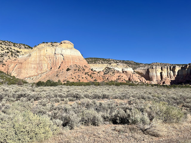
| Chama River Valley |
 |
| Cebolla, NM |
 |
| El Cuerno Cantina, Cebolla, NM |
 |
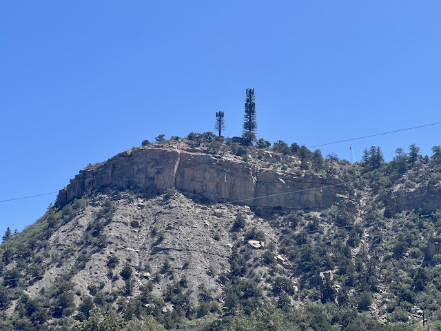
| Fauxliage; cell phone towers disguised as trees |
 |
| Susie and Greg, whom I had met in Libby, MT in 2019 |
 |
| The tour's second state! |
 |
| Map/Elevation Profile |


Comments
Post a Comment