Great Divide (NOBO) - Day #10 Horca, CO to El Norte, CO
Great Divide (NOBO) - Day #10
June 5, 2022
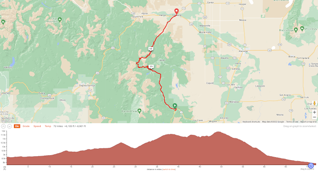
Horca, CO to El Norte, CO - 72 Miles
Start 7:09 AM Finish 6:49 PM
Total Duration 11:40
Moving Time 9:09
Stopped Time 2:30
Ascent 6,105 Feet
Descent 6,901 Feet
Tour Total 734 Miles
Details at: https://ridewithgps.com/trips/92387911
I slept great last night at Elk Creek campground. My tent was pitched in the grass, alongside the gravel, and I was near the bathroom building. I hung my cheese smelling tire repair kit from a hook next to the picnic table. I had strange funny dreams and stayed warm. I noticed some of the seams in the top of my tent were fraying. It would need to be repaired when I got home. It was chilly when I got up, and once on the road I had to pull over to put on my down sweater, long finger gloves, and glove liners. Once I got my clothing settled, I was comfortable riding a nice smooth gravel road alongside the roaring Conejos River. Everything around me was green and lush.
I was unable to dictate with my long finger gloves and the bumpy road. The road got rough and there were washboards. I was riding on National Park Road 250. Chipmunks were darting back-and-forth across the gravel. The road was absolutely pristine with not a speck of litter. I was in the Rio Grande National Forest, and I passed the Notch trailhead. I was riding through a deep narrow valley carved by the river. There were several horse ranches, and a number of pick-up trucks passed me going both directions. I would be following the Conejos all the way to Platoro.
I passed Spectacle Lake and saw the campground. I noticed a sign saying that I was entering Rocky Mountain Estates, elevation 8,800’. The store at Rocky Mountain Lodge wasn’t yet open at 8:30 AM when I rode through. I could see snowfields on the distant peaks across the valley. I had read on the Great Divide Facebook group that two riders had to walk five miles through snow north of Steamboat.
Sunlight crept into the valley as I was climbing. I was getting warm so I pulled over to remove all of my layers down to my cycling shorts and short-sleeve shirt. I put on my arm protectors and lathered myself with sunscreen. The mosquitoes were out in force, and It was a race to get going again. As I continued up the pass, the sky began getting hazy. There were numerous shades of green on the hilltop across the river. The fir trees were pointy and the Aspen were rounded.
Many motor vehicles passed me on the road, and they all kicked up dust. A barometer of a motorist’s consideration was whether or not they would slow down or stop to let the dust settle as I passed. I came to the lower South Fork Trailhead and was over halfway to Platoro. I came to the turn off for National Park Road 105 and could see buildings in the valley to my left. I was six miles from the small town. It was overcast and I had a tailwind. I passed Lake Fork campground and was getting close to town. It was 10:17 AM and I was hungry. This would be the day's only service stop, and I was trying to keep my expectations low. I had two bags of refried beans just in case.
As I was climbing I noticed small streams and tiny waterfalls to my right. To my left was the roar of the whitewater Conejos, and I fantasized about rafting it. As I neared Platoro, the wind shifted and was in my face. Platoro is a contraction of the Spanish words plata and oro - silver and gold. I finally rounded a bend and could see the town in the distance. I was keeping my fingers crossed. As soon as I saw the signs for ‘Cafe’ and ‘Lodge’ I did a beeline. I crossed the wrong bridge and ended up cutting through people’s yards.
Skyline lodge was peculiar and empty, and it smelled like fireplace smoke. I ordered two cheeseburger meals with fries, along with four cokes. The bill came to $46 and I sat out front on the porch. As I ate, I watched a family play stick with their dog alongside the river. Inside the lodge near the bathroom was a leaderboard from the 2021 Great Divide Race. There was no WiFi, and I hadn’t had phone or Internet service since I entered Colorado.
There was a headwind as I left the lodge, and I had two 11,000’ plus passes to climb. The fir trees on the other side of the valley were all dead, probably from an invasive insect. I kept climbing and came to the intersection of National Forest Road 247. I continued on 250. I reached the summit of 10,541’ Stunner Pass and there was no sign to document. I noticed a turn-off for National Parks Road 257, and I stayed on 250.
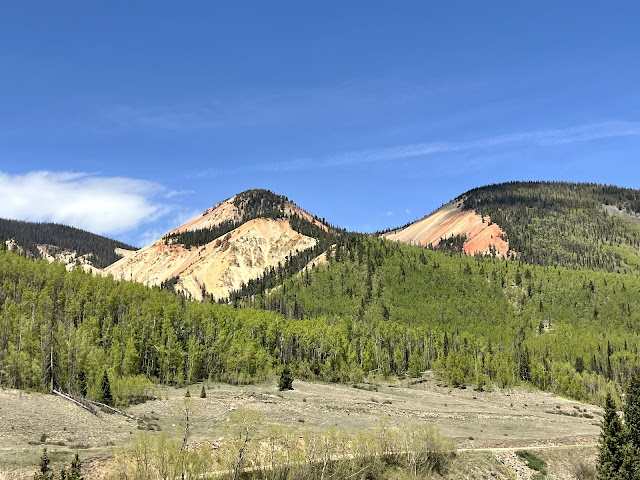
The hazy clouds had consolidated and the sky had become blue. There were now about a dozen puffy white clouds. I rode through a fantastic painted canyon with psychedelic skeins of off-whites, browns, yellows, grays, siennas, and crimsons. I rode down into a valley and crossed the Alamosa River. Climbing back up the other side of the valley I passed the Stunner Campground, which included a cabin for inclement weather. Knuckleheads were driving dune buggies in both directions and kicking up clouds of dust. There were also dudes on motorcycles. I was passing dirty piles of snow on the side of the road. I rode by Lake de Nolde, which was private. No trespassing signs lined the property.
I came to the intersection of 243 and stayed on National Park Road 380. It was continuous uphill and I was now at 11,130’. I was taking a lot of breaks, as I sipped water and looked at my digital map. I ran into three through-hikers; Nature, Buck Wild, and Pirate. They had started April 11, and had issues with the fires in New Mexico.
I kept climbing. There were still a few trees to the side of the road but it was mostly meadows with ponds, swamps, and small streams. A year ago I brought my mom‘s ashes to the top of Flattop Mountain in Rocky Mountain National Park. I felt bad about leaving her remains up on the top of that cold inhospitable mountain, but it was what she wanted. My mom loved the Rocky Mountains and she relished Colorado. I was feeling at one with her up here.
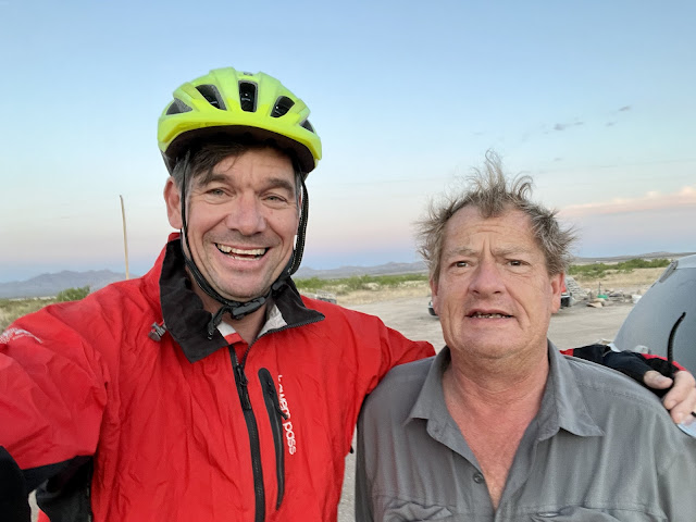
I finally caught up the the fourth through-hiker, Mr. fabulous from East New York Brooklyn. They had all spent the night in Platoro had eaten at a better place than the Skyline Lodge. He recommended the Far Out app. The other place in Platoro had better ratings than Skyline. He mentioned that they had to take an alternate route when they got to Colorado because the trail was snowed in. He also mentioned that the water in this area wasn’t safe to drink. At the painted valley I had noticed a sign about the high acidity in the water. I left National Park Road 380 and took unsigned 330 towards Summitville.
Eventually I turned a corner and could see buildings in the distance. I rode across a plain and passed tall sticks with red reflectors that lined the road. The winter snow must get really deep here. Summitville was essentially a ghost town, and I noticed a plethora of dilapidated structures. I saw what I believed to be a contemporary mining operation, but it was the Sommerville Mine Superfund Site. A sign read, ‘Hazardous Materials and Unsafe Conditions Exist. Do Not Enter’. You gotta love how miners go in and trash the land and reap the wealth, and then us taxpayers get stuck with the clean-up bill.
At 5:20 PM I reached the summit of 11,950’ Indiana Pass, the tallest peak on the Great Divide route. I didn’t see a sign for my documentation so I took a screenshot of my altimeter app. I had ridden forty-nine miles. It was thirty miles to Del Norte and all downhill. An additional incentive was that there was a brewery there.
I came to a junction and took a right on National Park Road 14 towards Del Norte. I was now twenty miles to my destination it was 5:38 PM. I screamed down the mountain at top speed, flying over the bumps and cruising through the gravel. I passed two elks alongside the road, and saw a sign that I was leaving the Rio Grande National Forest. At Castle Rock Road, I crossed over a bridge and was on pavement. I was still traveling downhill and was coasting at twenty-six miles an hour. The speed was way above my gearing and pedaling ability, so I sat back, relaxed, and enjoyed the ride.
The valley opened up wide, and the sun had set behind a ridge to the west. I finally got service and I punched in the Google directions to the brewery and searched for my sleeping options. I passed a bison in a field, and he let me photograph him. Then I pulled into Del Norte, population 1,458 and elevation 7,874’. The town had been established in 1872. I headed straight to Three Barrel Brewing Company and ordered a Burnt Toast Brown ale. I switched over to the IPA and ordered a pepperoni pizza. Afterwards I rode to the City Park where camping was permitted. A guy who lived next to the park warned my about raccoons. The batteries were dead in my front light, which was annoying. I also realized that I had lost my reading glasses. The park had an outlet, where I was able to charge my devices. I set up my tent and went to bed.
 |
| Elk Creek campground in Horca, CO |
 |
| The Conejos River |
 |
 |
| $46 lunch at the Skyline lodge in Platoro, CO |
 |
| CDT through-hikers; Nature, Buck Wild, and Pirate |
 |
| CDT through-hiker Mr. fabulous from East New York Brooklyn |
 |
| Sommerville Mine Superfund Site |
 |
| Del Norte, CO |
 |
| Map/Elevation Profile |


Comments
Post a Comment