Great Divide (NOBO) - Day #22 Pinedale, WY to Falls Campground, WY
Great Divide (NOBO) - Day #22
June 18, 2022
Pinedale, WY to Falls Campground, WY - 100 Miles
Start 6:52 AM Finish 8:31 PM
Total Duration 13:40
Moving Time 10:21
Stopped Time 3:19
Ascent 7,354 Feet
Descent 6,158 Feet
Tour Total 1604 Miles
Details at: https://ridewithgps.com/trips/93959162
I slept well at the city park in Pinedale. It didn’t get as cold as the past few nights. I woke up before the light and was able to roll back over and get another hour’s sleep. It was nice having a picnic table to lean my bike against, and pack in the morning. Thank goodness there was an out house in the park.
I rode over to the Wrangler Cafe and had the worst huevos rancheros I’ve ever had in my life. I should have known. It was essentially eggs over-easy, hash browns, chopped bacon and sausage, with red sauce, jalapeños, and tortillas on the side. There were no beans! I also had coffee and orange juice. The weather channel was blaring. Why did I need to know that it was snowing in New Hampshire?
I took US 191 out of town and there was a bike path to the right of the road. I was wearing my socks, leg-warmers, and jacket. There were no clouds to the west, and the moon was visible to the south. I rode through the sprawl and finally took a right on County Road 144, aka Ehman Lane, where there was also a bike path. The wind was supposed to be out of the south today and there were clouds to the east. I felt like I’d gone completely around the Wind River Range. I’d gotten so many perspectives and they were now to my east.
I saw the morning’s first pronghorn in front of someone’s house. It let me take it’s photo and then it pranced away. It then lost it's footing on the asphalt and fell down onto its front left shoulder. I felt bad for it. I could see on the map that there was a lot of pavement ahead, so I switched on my tail light. This part of Wyoming was filled with streams and green grass, and I noticed a number of horse farms. The pavement eventually ended and the dirt was smooth. I passed horse and cow pastures with snowcapped mountains in the distance. It was a really pleasant area. Colorful sparkly reflectors hung from the utility cables, ostensibly to protect birds. I came to State Highway 352 which was asphalt and took a right. I was now headed north.
I passed Cora, population 142. There was a post office and a few houses. I was getting hot so I pulled over to remove my leg-warmers and jacket. There was a flashing sign that read ‘Slow Down! Be Ready to Stop! Cows on Road June 16th and 20th’. Today was the 18th, so I didn’t need to worry. Plus I was used to cows on the road. On my paper map I noticed a town called Bronx to the east. It threw me every time I saw it.
I was cruising down a nice hill at twenty-two miles an hour and noticed a pronghorn off in the sagebrush to the right running at the same pace. The New Fork River was to my right and I was going upstream towards New Fork Lake. I saw two cowboys and their dogs driving a small herd of cattle. The houses and ranches in this part of the state were the nicest I’d seen in Wyoming. I suppose that wealth is linked to the availability of water.
I ran into south-bounder Louise from Berlin Germany. She had started in Banff, and had to skip a couple parts because of the snow. She was going all the way to Antelope Wells, and today was her twentieth day on the road. She told me that Andre and Gerda were just a minute ahead of me, and that Union Pass wasn’t that bad. There were just a couple places with snow. I stopped for a second to remove my socks, add sunscreen and my arm protectors. I passed a cyclist going in the same direction who was traveling slow and had only a half frame bag. I assumed that he wasn’t a divider and wished him a good morning as I flew by. The green river was now to my left.
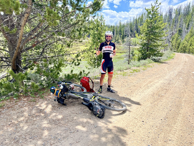
I entered Briger National Forest and the pavement ended. I caught up with Andre and Gerda and we proceeded ahead together. A forest ranger stopped us to warn that there was snow at the top of the pass. We would have to carry our bikes through about thirty yards of it. He asked if we knew what we were doing, and I replied, ‘yes’. He said that he had to rescue two Dutch cyclists two days ago, who were stricken with hyperthermia. There was a storm coming in later this afternoon and there was a warming hut ten miles before the pass. Afterwards I almost ran over an olive green snake that was squirming across the road.
As soon as I began the climb, my chain broke. It was a brand new chain, and maybe I should have left the old one on. As I was installing a quick link, several motorists pulled over to ask if I needed help. I was still in view of the ranger. It wasn't the best way to begin a pass. A racer passed me and didn’t stop. I caught up with Andre and Gerda, who had stopped to refill their water bottles from the river. Andre gave me another set of quick links, so that I would have two. Last week, one of the rails on his seat had broke, and he had fixed it with pieces of spare spokes and hose clamps. I used to carry spare hose clamps, and should perhaps put those back on my list.
I eventually got ahead of Andre and Gerda on the winding chunky bumpy climb. I passed sagebrush and bushes to the side of the road. Soon I was up in the aspen groves and then surrounded by fir trees. The dirt eventually became smooth, and the grade mellowed. I passed beautiful pastures and incredible views of the Wind River range. I met racer Brian from Birmingham, Alabama, who had stopped on the side of the road to eat a sandwich. He told me that there was snow up on top, and mud and snow on the descent. His shin was scraped, and he asked if I had a Band-Aid, which unfortunately I didn’t. He mentioned that he needed a new jacket. He had given his other one away away because it was too bulky and he had nowhere to store it. He lamented that he hadn’t planned very well. He asked if the racer ahead of him was on a single speed.
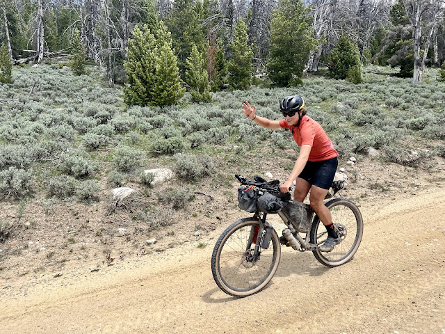
I passed the Strawberry warming shelter that the Ranger had told us about. There were three loaded gravel bikes parked out front. I crossed over a creek and passed the Fish Creek Guard Station. I traversed another stream and began climbing up the other side of the valley, as a female racer passed me. By 2 PM I had pedaled sixty miles, and was about four miles from the pass. I only had about 404’ of vertical climbing remaining. I was at 9,170’ elevation, and my surroundings were pleasant. I enjoyed being enveloped by densely packed fir trees, and relished their wonderful aroma.
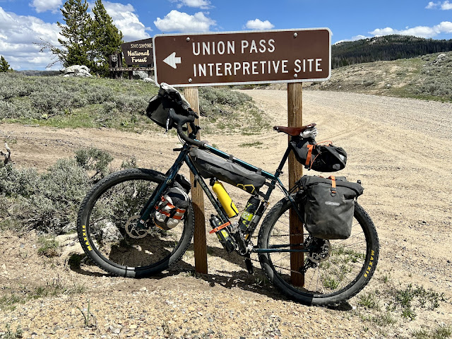
I was passing beautiful little brown ponds, and some of them were draining into muddy puddles in the road. I reached Union Pass at 2:30 PM and once again crossed the Continental Divide. I entered Shoshone National Forest, and was now on National Forest Road 263, also known as Union Pass Road. After the pass, I kept climbing and fortunately I had a strong tailwind. I came to the area where I had to walk across the snow in two places. Two motor vehicles were stuck, and I didn’t offer to help. I was wearing sandals and my bare feet got cold in the snow. I ran into southbound dividers Bastien and Elsa, from Toulouse France. They had started in Banff and told me where I could get food ahead, and where I could camp this evening. I told them about the Strawberry warming shelter and showed them my photo. They recognized the bikes that had been parked out front.
I made it up to 9,700’ before the downhill began. I met south-bound divider Christopher from Santa Fe who mentioned a restaurant in Hatchet, which was slightly off route. I came to Dunoir where I had originally planned to spend the night. The campground wasn’t appealing, and would be cold and possibly snowy if a storm came through. I figured that I could make it down the other side of the pass and obtain more mileage for the day. There was an alternative route to US Highway 287, but I wanted to stay on the main route. My map indicated a restaurant in Dunoir, and I asked someone who directed me to Crooked Creek Guest Ranch. I wandered a few dirt roads until I found it. There were numerous resorts and fancy ranches in the area. A wedding was being held at Crooked Creek and the restaurant was closed. The bartender let me purchase two cold bottles of Sam Adams, which I downed on a bench out front.
I rode out of the Dunoir and found myself on a narrow dirt road surrounded by pine trees. I did some steep climbing through a canyon carved by Warm Spring Creek. By 5:20 PM I’d ridden eight-four miles. It was becoming overcast and there were dark clouds ahead. I met two more racers who were hoping to make it to the warming shelter, which was now twenty-eight miles back. There was a lot of climbing in store for them. It started to drizzle and I stopped to put on my rain jacket. It never fully rained but I left my jacket on. I passed through an area that had burned a few years back. A pronghorn cautiously crossed the road in front of me. I climbed up over another ridge and left the Warm Spring Creek valley. I circled around a bend and was spellbound by an incredible butte with amazing sculpted rocks across the valley. I sped down into Wind River Valley and could see US Highway 287 in the distance. I rode by the Tiehack Memorial, and then got on US Highway 287 aka State Highway 26.
I pulled into the Lava Mountain Lodge for a well-deserved meal. The French couple had warned me not to camp here because it was $25 and showers were extra. Dogs had barked all night, and they hadn’t slept well. They had recommended a USFS campground a few miles further down the road. These remote mountain lodges were a racket. I grabbed my handlebar bag and searched for my iPad to edit this report while I was dining. I was shocked to find that my iPad wasn’t in it’s spot. I frantically looked in my other pannier. It was gone. I had either left it at the brewery last night or it was stolen. I had heard footsteps in the campground this morning, but no one would have known where I kept my things. I was upset. Blogging from my phone was going to be a dilemma.
There were several dividers in the restaurant. I ordered a cold bottle of Grolsch, along with the blue cheeseburger and fries. A lost motorist was trying to get home to Illinois. I tried calling the brewery in Pinedale, but couldn’t get through, so I sent them an email. I was exhausted and depleted. I talked with a female racer who was hoping to make it to the Strawberry warming shelter tonight. That would be a thirty-eight mile steep uphill through chunky mud and snow, and she would finish in the dark. The restaurant closed at 9pm, so I only had enough time for three beers. I then rode the four miles to Falls Campground. I had been on this stretch before in 2018 when I rode from Dubois to Jenny Lake. I remembered Pinnacle Buttes, but didn’t recall seeing so much snow last time. I was now in grizzly bear territory. Going forward I would need to camp in as many USFS campgrounds as possible, because they had bear boxes. I would also need to sleep with my bear spray right next to me.
 |
| Fellow north-bounders Andre and Gerda |
 |
| Camping at the City Park in Pinedale |
 |
| Moments before this poor pronghorn wiped out |
 |
| South-bounder Louise from Berlin |
 |
| Breaker of Chains |
 |
| Tour Divide racer |
 |
| Fellow north-bounders Andre and Gerda |
 |
| Tour Divide racer Brian from Birmingham, AL |
 |
| North-bound dividers parked at the Strawberry warming shelter |
 |
| Tour Divide racer Zoe from Brussels |
 |
| Union Pass |
 |
| Union Pass |
 |
| Southbound divider Bastien from Toulouse France |
 |
| Southbound divider Elsa from Toulouse France |
 |
| Tour Divide racer |
 |
| Tour Divide racer |


Comments
Post a Comment