Great Divide (NOBO) - Day #36 Eureka, MT to Fernie, BC
Great Divide (NOBO) - Day #36
July 4 2022
Eureka, MT to Fernie, BC - 78 Miles
Start 7:52 AM Finish 6:57 PM
Total Duration 11:05
Moving Time 8:21
Stopped Time 2:43
Ascent 4,628 Feet
Descent 3,999 Feet
Tour Total 2,664 Miles
Details at: https://ridewithgps.com/trips/95498863
I slept incredibly well last night in room number 202 at the Silverado Motel in Eureka. My body was completely trashed from yesterday’s ride in the cold rain and I slept hard. I woke up with the light and tried to keep sleeping. I was sore and tired. Friends had shared this story from the New York Times: https://www.nytimes.com/2022/07/04/sports/tour-divide-race-bikepackers.html. This race is epic and seriously deserves the media attention. I packed up my dry clothing and shaved. All of my devices were charged. The toilet in my room had overflowed, I was a day late on the reports, and I was burning the candle at both ends.
I grabbed two blueberry muffins from the hotel reception area and then went across the street to the Exxon station for an orange juice. I took Highway 37 for a mile west towards Rexford and Libby, where I had gone in 2019. This time I cut a north on Airport Road towards the border. It was 54°F and I was wearing my jacket, and no leg-warmers or socks. It was forecast to rain later this afternoon and I was keeping my fingers crossed. The clouds were hanging low along the mountain ridges and I could see a large weather system to the west.
Last night Andre & Gerda told me about the Arrive CAN app that I would need to get into Canada. I uploaded an image of my passport and my vaccination certificate. Gerda sold me some Canadian dollars and Andre then teased me about handing his wife cash in a hotel room. I had heard from Don who was having dinner with Otso and Nora at Trixi’s Antler Saloon in Ovando.
I stopped at the First and Last Chance Bar and Duty-Free Store in Roosville. I was hungry and the proprietor told me he had food, but I’d need to wait until he had time to cook it. There was a cyclist out front talking on his phone and I heard that he was also trying to make it to Fernie today. I crossed through the US border station and noticed the sprawling artwork by Patricia Leighton and Del Geist, a series of large boulders propped up on steel legs and surrounded by grass covered crescent-shaped mounds.
I showed my Arrive CAN app to the Canadian customs officer and was now in British Columbia. The highway continued as 93 North. I was now on the ACA Great Divide Canada section, my final map segment. I had elected to take the main route to Sparwood instead of the Flathead Alternate. If I had done my homework I would have chosen the challenging alternate, which was colorfully known as the 'Serengeti of North America'. The goal for the day was Fernie, and my heart skipped a beat when I saw a sign reading that it was 69 ahead. Then I realized it was in kilometers.
I stopped at the Grasmere General store, and got myself a container of potato salad and a Gatorade. I was cold and put on my socks and leg-warmers. I tried to figure out and activate my Canadian phone plan, and there wasn’t any service in Grasmere. The gravel parking lot in front of the store was filled with huge puddles. It had rained buckets yesterday. I took a left on Grassmere Dorr Road.
Yesterday had been a harrowing experience. I had gotten cold and my down sweater had become soaked. My body was able to create just barely enough warmth, but it was a fine line. I still had the merino wool long underwear in my bag but, with the deluge, there hadn't been a place to change. I talked about this last night with Andre, and they had used ponchos. He told me that they draped them over their handlebars which additionally kept their legs warm. I was lucky yesterday that the temperature didn’t plummet. That’s what had happened here at the beginning of the Tour Divide, when fifteen riders were stricken with hypothermia.
Highway 93 basically made a straight shot from Whitefish to Fernie, but my route meandered all over the place. I found myself headed back south towards the border on a big loop. My map route resembled the profile of a distorted face, with a large chin and pointy nose. I rode around the chin and the pavement turned to gravel. I entered First People lands. From the many road signs it was obvious that the First People and Canadian government took COVID much more seriously than in the US.
It was sad leaving Montana, because I wasn’t sure when I’d next return. I’ve twice crossed the state east to west by bicycle. This was the first time that I’d crossed south to north though the mountainous west. I spent twelve nights this time. I like Montana, and I respect it’s mettle. I think the land is beautiful, and I enjoy the people and it's beer.
At the tip of the nose I took a right on Dorr Cut-off Road back towards Highway 93. The benefit of this long meandering route was that I could space out and enjoy the incredible beauty. I didn’t have to worry about motorized traffic. I ran into south-bounders Malik and Denise from Oregon and Christian from Utah. They warned me that I needed a horn for the bears. They also told me about a muddy section north of Fernie. Several times now I had heard the story of the cyclist who was pursued by a grizzly bear and was saved by a motorist in a pick-up truck. There’s a video at: https://globalnews.ca/video/3616607/quick-thinking-drivers-save-cyclist-from-possible-bear-attack-on-b-c-highway
I returned to Highway 93 and took a left. The highway crossed straight down into a canyon where it traversed the Elk River. There was a long uphill on the other side. I took a left on Fitzpatrick Road towards Baynes Lake. I was admiring the scenery with beautiful grass and fir trees, and then I rounded a corner that had been clear-cut. Eventually beautiful Lake Koocanusa appeared to the left.
I rode through Baynes Lake and saw a sign that I was on the Trans Canadian Trail. I passed the noisy TCL Elko compression facility. The sun finally came out. It had been going in and out all morning and there were still large clouds in the sky. The route met back up with Highway 93, and this time I took a right.
There were a lot of logging trucks and I saw my first 'Caution for Logging Trucks' warning sign. The shoulder was littered with bark. I stopped at 3 & 93 Dairy Bar for a 3 & 93 burger, which consisted of three patties with cheese, bacon, and mushrooms. I also got a root beer float. I met three south-bounders from Philadelphia whom had started in Banff. They had had all sorts of problems with airlines and shipping. One of their racks was broken which cost a fortune to replace. They warned me about a washed out road between Sparwood and Elkford.
The sun was now blazing and I removed my jacket, leg-warmers, and socks. I added sunscreen and my arm protectors. I got a little turned around in Elko but finally made my way to the Elk Valley Trail heading upstream along the Elk River. I was on dirt and it was much better than yesterday, because it was dry.
The Elk Valley Trail was marked on my map as a bike trail. The bold dotted symbol had always indicted asphalt rail-trail grade on other ACA maps. Here it was actually a gravel road running along a set of railroad tracks parallel to the river. Highway 3 was on the other side. I found myself in a deep compact valley with the towering Morrissey Ridge to the east and the Lizard Range to the west.
I met two south-bounders who were riding from Banff to Antelope Wells. They reported that the mud had dried up but that the mosquitoes were bad ahead. The next section was chunky mosquito infested two-track. I missed a turn because it was so primitive and I had to hike-a-bike the first part. Every time I stopped I was attacked by swarms of mosquitoes.
Finally the smooth gravel returned. I would occasionally check my blue bubble on the navigation app, and realized that I was off route. I turned around and returned half a mile to find the single-track turn-off. I didn’t see any tire tracks and much of it was overgrown. I came to a section of missing road, and then I heard cracks of thunder. It started to rain. I did my best to follow the meandering single track and it was absurd. At one point I could see Fernie, far down in the valley below. I noticed a road along the river that headed straight into town. I was way up on the ridge weaving in and out of thick forest in a blinding torrent. I passed a sign that read the trail was closed ahead, and I proceeded. A downed tree blocked the first bridge and I was able to carry my bike over it. The second bridge was completely gone, and I had to ford the stream. I finally reached a logging road and took a right. I continued until I came to a complete wash-out. The stream had totally destroyed the road, and it was impossible to cross. I needed to get down the ridge to the river. I turned around and began to navigate by intuition. It was pouring, and my phone was impossible to operate. I couldn’t use my goggles and I needed to get down to the valley.
The first road I took ended with a washout. Then I had to climb back up. I was now headed back south and it was frustrating. It kept raining and I was getting cold. I came to a washed out section and had a challenging crossing. I had done a bunch of these muddy gullies, but I was tired, wet, and cold. I finally found a logging road headed down to the valley. I took a chance and followed it. Finally, at long last, I was reconnected with the railroad tracks and river. I was now on the road that I’d seen from up on the ridge. I was chilly, soggy, and slowing proceeding towards Fernie. I eventually began encountering houses and businesses, and it was still raining. I rode into town and my Canadian phone plan still wasn’t working. My goggles were covered with rain drops and my phone wouldn't cooperate. I needed a hotel and every place was booked. It was still drizzling and I was contemplating either the RV park or stealth camping under a pavilion in a city park. I would have paid anything to stay and enjoy the heat inside the Park Place Hotel. On my way over to the RV park I took a chance and walked into the Raging Elk Hostel. They had ‘pods’ available and I was offered Kodiak Four. I stored my bike in the basement and went upstairs to take a hot shower. I laundered my dirty clothing in the shower and hung my clothing and gear throughout the hostel.
I went to the pub and quickly relished two Margaritas. I proceeded with pints of Fernie Huckleberry Ale along with a serving of poutine. I edited this report while enjoying delightful live music.
 |
| Room # 202 at the Silverado Motel, Eureka, MT |
 |
| Distant Lewis Range to the east |
 |
| Final map section |
 |
| Canadian Long Horn |
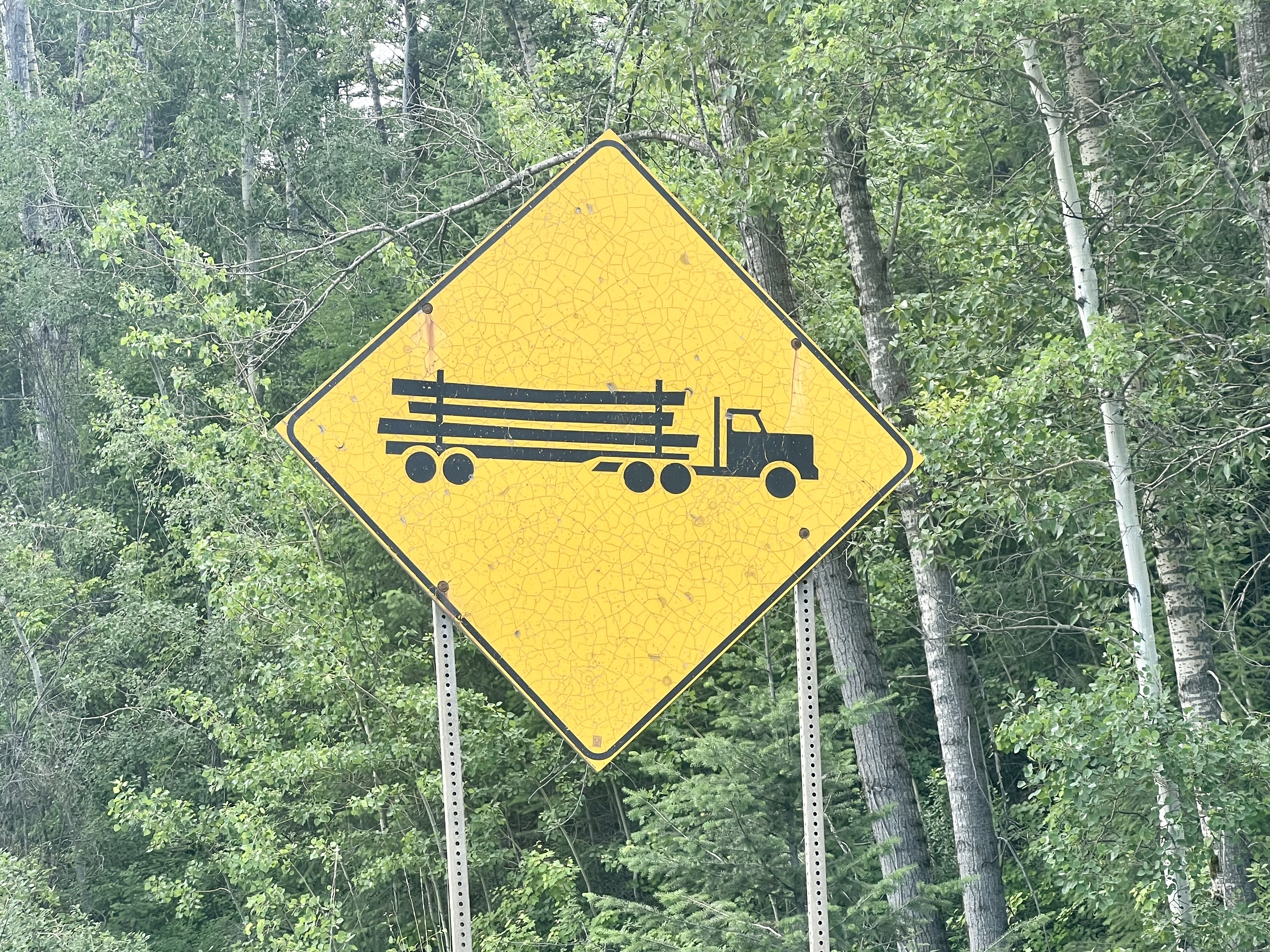 |
| Caution logging trucks |
 |
| Southbound cyclists from Philadelphia |
 |
| Trail erosion from the Elk River |
 |
| Elk Valley Trail |
 |
| Elk Valley Trail |
 |
| Elk Valley Trail |
 |
| Washed out logging roads |
 |
| Elk Valley Trail Confusion (in pouring down rain) |
 |
| Map/Elevation Profile |


Comments
Post a Comment