Great Divide (NOBO) - Day #27 Lima, MT to Grant, MT
Great Divide (NOBO) - Day #27
June 24, 2022
Lima, MT to Grant, MT - 69 Miles
Start 9:03 AM Finish 4:49 PM
Total Duration 7:46
Moving Time 6:51
Stopped Time :55
Ascent 3,192 Feet
Descent 3,639 Feet
Tour Total 1,996 Miles
Details at: https://ridewithgps.com/trips/94477204
The Mountain View RV Park was located adjacent to I-15, which meant that my first night in Montana was like camping in the middle of the Brooklyn Queens Expressway. I woke up several times thinking a semi truck was blasting through my tent. My ear plugs didn’t do much good. At one point, one of them fell out and I couldn’t find it. I fondly missed quiet Grassy Lake from two nights ago. That said, I was now showered, shaved, my devices were charged, and my reports were up to date. I had fun at Peat Steakhouse last night and had turned in past 11 PM two nights in a row.
I had pitched my tent behind a small fir tree and was shaded from the sun this morning. It was the latest that I had slept in. Don’s tent was already struck when I climbed out of mine. I stepped on one of my tent stakes and snapped it in two. It was warmer last night and I didn’t notice any mosquitoes. There was no condensation in my tent this morning. Jan’s cafe didn’t open until 8AM, and I was the first customer. I ordered eggs over-easy with bacon, two pancakes, a large orange juice and coffee. Don had picked up a latte from LiL BAr Brew, a small coffee stand in front of the Mountain View, and I was envious.
I started the ride in my shorts, short sleeve shirt, and leg warmers. I was on Western Frontage Road, which was asphalt and paralleled I-15. I would be going around the west side of the Tendoy Mountains. I took a left on Big Sheep Creek road, which was gravel. I was on the Big Sheep Creek National Back Country Byway. Don pointed out a bald eagle and the blue wild flax flowers on the side of the road. There was a gap between the Tendoy Mountains and the White Fur Ridge, and I climbed up through middle following Big Sheep Creek.
A southbound male and female couple passed me. I was riding through a narrow twisted canyon with huge rock walls to either side. At 10:30 AM it got cloudy. The weather forecast had called for sun the next seven days, but things could change at any moment. The canyon opened up to a wide valley filled with grass and peppered with sage. I passed a group of seven day cyclists. There was a strong headwind from the south, and the road hooked right through another narrow meandering canyon. I came to an intersection and took a right on Medicine Lodge Road. I continued through a twisty narrow valley which eventually opened up into a wide valley, with the snowcapped Beaverhead Mountains on the far side. The sun came back out.
A oncoming motorist in a blue pick-up truck slowed down and then stopped. He rolled down his window and introduced himself as Cal, an extension of Jeffery Sharp. He was a trail angel riding around handing out water and Gatorade to hikers and cyclists. Three young south-bounders from Utah whom had started at the Canadian border rolled up. One of them was going all the way to Antelope Wells. Afterwards, a long slog climb began straight up the pass on loose gravel. It was tough and steep, and I didn’t once walk or foot down.
I crossed over the Medicine Lodge Sheep Creek Divide, and found myself on the old Bannack Road between Corinne Utah and Bannack Montana. It had been established in 1862. On the downhill I passed a south-bound cyclist walking his bike up the other side.
I was following the Medicine Lodge Creek downstream. The valley opened up wide and was packed with sagebrush. The sun was out in full force. A badger crossed the road right in front of me. I ran into south-bounder Moez, who confirmed that there was a place to get food in Grant. The wind was out of the north giving me a strong headwind. It had been forecast to be out of the west.
I stopped to flip my map and Don pointed out Teepee mountain, which had been sacred to the Bannack tribe. I ran into south-bounder Jason from Port Townsend Washington. He had started at the border and was doing an ITT. He had missed the turn-off to Grant and was short on water. He was planning to filter water from the stream on the pass. I gave him a liter of water and dissuaded him.
I took a left on State Highway 324, which was pavement and had a really tough headwind. I finally arrived at Horse Prairie Stage Stop and met Amy the proprietor. The saloon and restaurant weren’t yet open, and Don and I were invited to set up out tents out back. I managed to erect my tent in the wind using rocks as ballast, and then went to the bar. I ordered a Moose Drool and then a Salmon Fly Honey Rye from Madison River brewing Company. I got the rib eye steak with a baked potato and salad. The meat was tough and I practically choked on a large piece. Don almost had to perform the Heimlich maneuver. I played shake a day and lost a dollar. I later got a half order of nachos and enjoyed more Salmon Fly Honey Ryes. There was a rodeo playing on the television, while I edited this report.
 |
| Mountain View RV Park in Lima, MT |
 |
| Mountain View RV Park shoe tree with I-15 in the background |
 |
| Bison herd outside of Lima |
 |
| Big Sheep Creek Road |
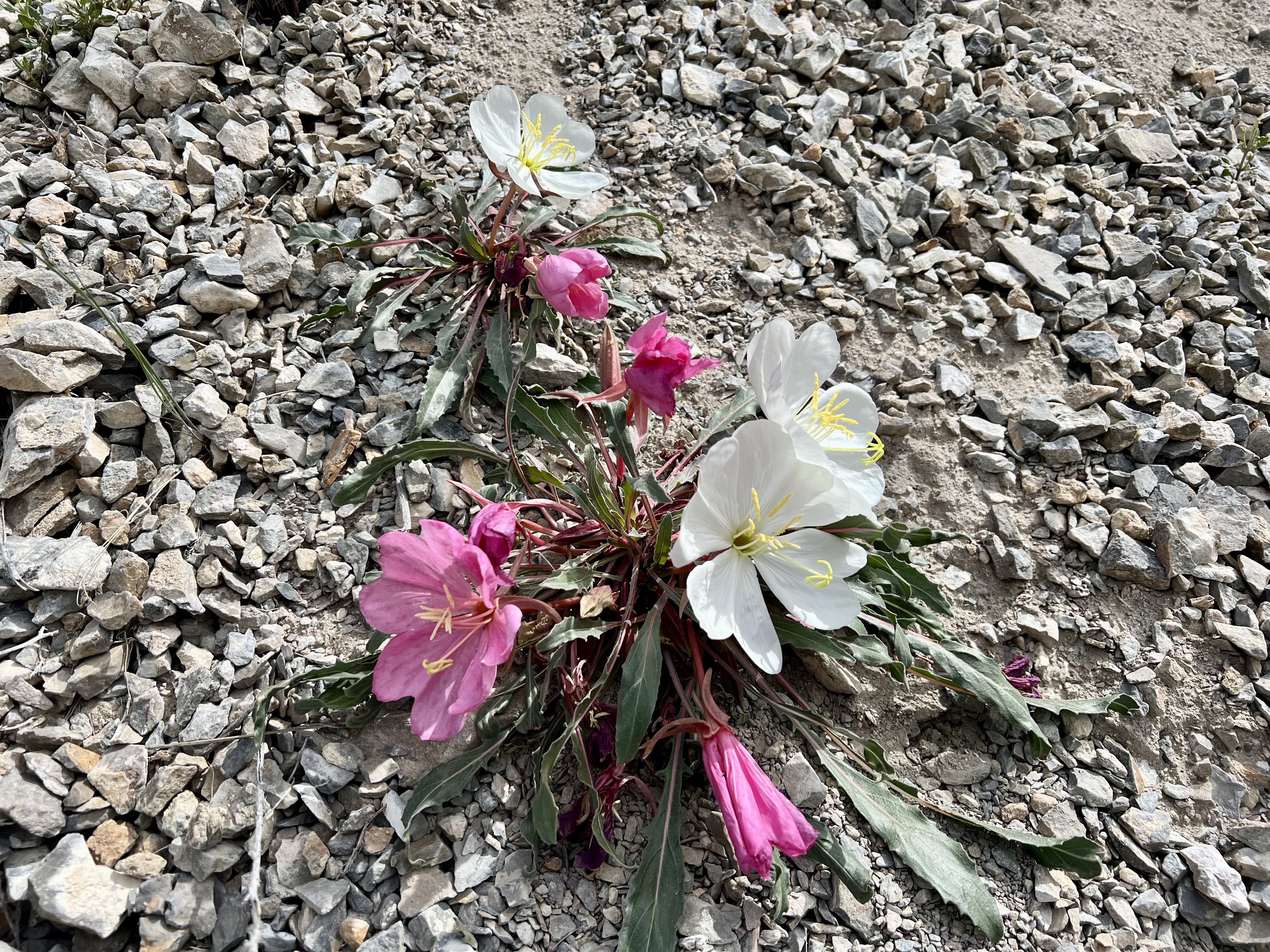 |
| Tufted evening primrose |
 |
| Lemhi Range in the distance |
 |
| Don, trail angel Cal, and three south-bounders from Utah |
 |
| Beaverhead Mountains |
 |
| Medicine Lodge Road with Don up ahead |
 |
| Endless sagebrush |
 |
| Medicine Lodge Road |
 |
| Polemonium |

 |
| Old Bannack Road |
 |
| Medicine Lodge Road |
 |
| Map/Elevation Profile |


Comments
Post a Comment