Great Divide (NOBO) - Day #26 Henrys Lake, ID to Lima, MT
Great Divide (NOBO) - Day #26
June 23, 2022
Henrys Lake, ID to Lima, MT - 80 Miles
Start 7:43 AM Finish 5:00 PM
Total Duration 9:17
Moving Time 8:05
Stopped Time 1:11
Ascent 3,292 Feet
Descent 3,512 Feet
Tour Total 1927 Miles
Details at: https://ridewithgps.com/trips/94368070
I stayed up past 11 PM last night editing yesterday’s report. That’s really late on a bike tour. It was pitch black when I went out to crush my beer cans, hang my garbage, and brush my teeth. The moon was a waning crescent and I hadn’t seen it for several days. It got cold during the night and I had weird dreams. I could hear the cars from US 20. There was a lot of condensation this morning. My tent, sandals and gloves were all wet. I started the ride wearing my socks, leg-warmers, down sweater, jacket, and short finger gloves. Because I had stayed up so late, I got a late start this morning, and the sun was already above the trees when I got on the road.
I took a left on County Road 053 aka Red Rock Road, which was paved. I was back in the shade, and my fingertips were freezing. I passed more turn-offs with motorists camping, and was glad that I had ducked off the road when it was still gravel. Sawtelle Peak was now to my left. I came to the expansive Centennial Valley which was filled with sagebrush and green grass. There was an impressive range on the other side and I passed several handsome ranches. I rode by the RV park where I had originally planned to stop last night. It was a horrible mini city of RVs, and I stopped to deposit my garbage. The store was still closed.
I finally got a good view of Henrys lake which sat at the edge of the Tonghee Peak on the other side of the valley. The pavement ended and I found myself on gravel. I took a left on Red Rock Road towards Red Rock Pass. I pulled over to strip down to my shorts, short sleeve shirt, and add my arm protectors for the pass. There were many motorists on this road, including ATVs, trucks pulling RVs, and trucks pulling rafts on trailers. All of them kicked up big plumes of dirt, and I had to lift my buff up over my face.
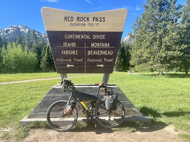
I got to the top of 7,120’ Red Rock Pass and once again crossed the Continental Divide. I was back on the Atlantic side. I entered Montana and was now in my fifth and final state. I was also now in Beaverhead National Forest. There was a welcome sign for the southbound tour dividers and three racers were there taking photos. I took one too. Idaho, I only spent one night with you. You are gorgeous! The smooth cinder ended and Montana served up big chunky rocks and dirt. I was noticing a possible issue with my rear brake, which was making alarming high tension pings. I passed another Tour Divider.
I noticed a giant piece of road equipment capable of scraping and smoothing the road surface. I crossed a cattle guard and the dirt was much better. I then passed a southbound female divider. I entered Red Rocks National Wildlife Refuge, and got honked at by a pick-up truck with Utah plates. I had been riding down the center of the gravel on the smooth tire tracks. I passed two south-bounders and then three more.
I rounded a bend and admired 6936’ snow covered Arrowhead Mountain. The wind was from the south, and was strong. I headed directly into the breeze on one stretch, and then took a right and it was against my shoulder. My core was chilly. I rode alongside 9506’ snow covered Taylor Mountain to my left. Upper Red Rocks Lake was to my right. I could see the settlement of Lakeview in the distance. I pulled over at a swan nesting site to enjoy a few pieces of tortilla and cashew butter. Two more southbound dividers passed me. There were a dozen buildings and a lookout tower in Lakeview, no population listed. There were no services, and I passed another southbound divider.
Centennial Valley was cut by the Red Rock River. I rode through endless meadows of rich lush green grass and enjoyed the pleasant aroma of Lupine flowers. Orange lichen covered the scattered giant boulders. I admired the distant rounded ridges and more remote 8274’ snowcapped Antelope Peak. I spotted the first pronghorn that I had seen in days. Then I saw four more. And then I noticed another seven. I took a right on North Valley Road, and got a tail wind. I flew across Centennial Valley. There were fenced in cattle to either side of the road. The surface was really bumpy, and I passed two more south-bounders. I crossed over the Red Rock River.
I kept going north and the road finally turned west. I stopped and talked to a south-bound Tour Divider, and after a few more miles I passed a female Tour Divider. I stopped to remove my socks and then took a left on Lima Dam Road. I was now going directly into the wind. The road eventually shifted west and I had a cross wind. There were large snowcapped mountains to the west. The puffy clouds were starting to conglomerate, and there were large dark clouds to the north and northwest.
I was riding along the north edge of the valley which was slowly beginning to narrow. Lima Reservoir was to my left, and I could see a narrow twisting valley ahead beyond the dam. A bunny ran across the road, and then I saw some geese. I noticed swan, pelicans, and ducks in the reservoir. I passed another southbound divider as I was riding down into the valley.
Dark clouds were forming and it was staring to get gloomy. I rode through thick disgusting clouds of gnats and then I heard a thunder clap. I was ten miles from my destination and it was 3:50 PM. I had ridden seventy-one miles. It started to thunder and then drizzle. I stopped to put on my rain jacket and a strong scary wind kicked up. I noticed a corral on the side of the road with a roof enclosure. I rode over and kept my back up against the wall. Soon afterwards a southbound cyclist rolled in and then three more. Three of them were together and one was solo. Apparently there were others in their pack. They had all started in Banff, and we traded stories until the wind died down. I learned where I could eat in Lima and in Grant.
The storm changed the wind direction and I had a wicked headwind getting into Lima. Two more southbound dividers passed me as I was fighting the breeze. I rode around a corner and could then see Lima in the distance. Behind it was I-15 and beyond that was the impressive White Pine Ridge. I rode into town, crossed the railroad tracks, and took a left on Harrison Street. I stopped at the Exxon for a Pepsi on ice and then went to Jan’s Homestead Cafe where I ordered a Cowboy Burger and several Pepsis. Don later appeared and we got caught up.
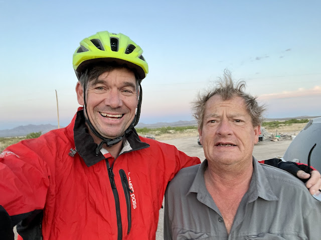
I went across the street to Mountain View RV park, where I set up my tent. The proprietor gave me a towel and a key to sketchy room #9, where I was able to shower and shave. Afterwards I took photos of the local shoe tree. I talked to a racer who was staying in one of the rooms. He had broken a rack and was waiting for a replacement. I rode over to the Peat Steakhouse & Saloon where I ordered a Philipsburg Brewing Company Razu with chips and salsa. I ordered a few margaritas and then switched to the Hazy IPA from Missoula. I ordered a Caesar salad, and Don later joined me. He told me that he had passed Caity and Jens today on the route. I closed down the bar as I recharged my devices and edited this report.
 |
| Henrys Lake State park, ID |
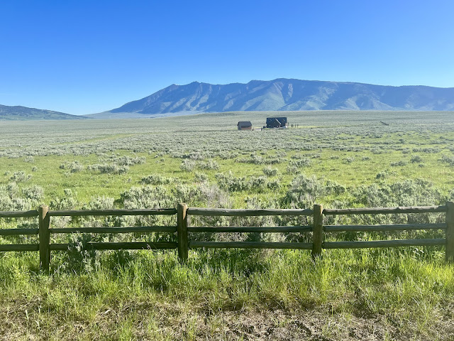 |
| Centennial Valley |
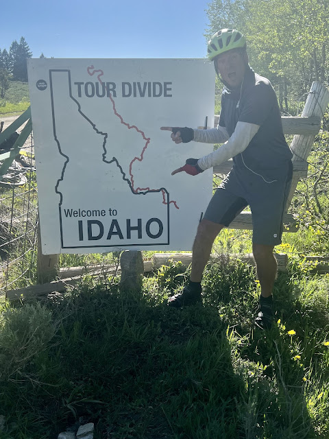 |
| Leaving Idaho |
 |
| Approaching storm clouds |
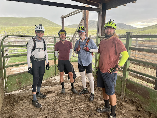 |
| Seeking shelter from the storm |
 |
| Map/Elevation Profile |





Comments
Post a Comment