Great Divide (NOBO) - Day #18 Slater, CO to Rawlins, WY
Great Divide (NOBO) - Day #18
June 14, 2022
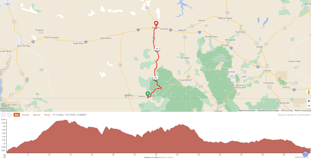
Slater, CO to Rawlins, WY - 71 Miles
Start 6:55 AM Finish 3:17 PM
Total Duration 8:22
Moving Time 7:14
Stopped Time 1:08
Ascent 5,715 Feet
Descent 5,508 Feet
Tour Total 1,282 Miles
Details at: https://ridewithgps.com/trips/93356236
I slept great in a cabin at Riverbend Camping in Slater. It was cold last night and I had closed all of the windows. It rained throughout the night and I stayed warm and dry in my silk liner and down bag on a lower bunk bed. There were cows behind the cabin that moo-ed throughout the night. I woke up with the light and packed up. Before I left I got some water from Rick who poured from a pitcher he had in the refrigerator. There had been a sign at the bathroom sink saying not to drink the water. He told me to keep an eye out for cougars, bears, and wolves, and said there would be nothing between here and Rawlins, which was my destination.
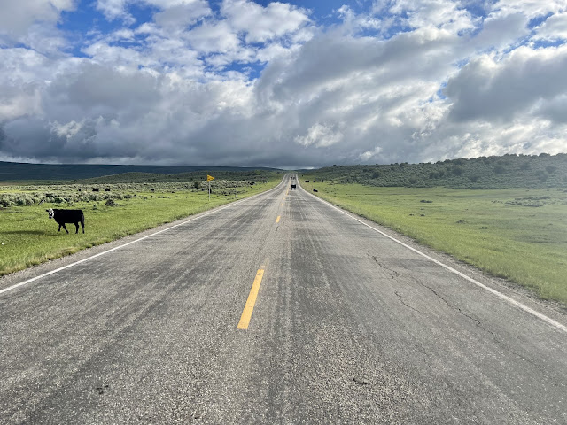
I turned right on State Highway 70 which was asphalt. Rick had said that that his fence line was the state border, so I was now now back in Wyoming. It was cold out on the road and I was wearing my rain jacket and leg-warmers. My fingertips were freezing. Clouds were hanging low in the sky, and I couldn’t see the tops of several ridges. After a quick climb I had a nice long downhill and my body was ice cold. I passed Wyoming Carson County Road 710, which was the other side of the Columbine Alternate Route. My rear light and radar were on, and there weren’t very many motorists on the road. The air was still.
Like my first night in Colorado, there were no services at my last. Colorado was good to me. I had a lot of fun, ate well, the wind was generous, and there was plenty of water. Colorado challenged me with the climbs, and there were a few gnarly ones.
There were dark clouds to the north, where I was headed. I wouldn't want to be out here in the middle of a cold rainstorm or snowstorm. There’s no refuge. From my 2018 Trans Am tour I knew that Wyoming could be tough. I vividly remembered the wind and mosquitoes. I also recalled spending Fourth of July in Lander, with the fireworks and most magnificent parade I’ve ever experienced. I'd never forget the thrilling rodeo. And of course the Tetons, one of my favorite mountain ranges.
I began the Scenic Byway towards Battle Pass. I noticed a sign that I had entered Medicine Bow National Forest. My toes were freezing, my fingertips were frozen solid, and my core was chilly. Finally the sun peaked through the clouds to warm me up. Fortunately the sun stayed out because I was starting to think about my down sweater, rain pants, waterproof socks, and long finger gloves. I was climbing through open range alongside grass, aspen trees, bushes, rocks, and the occasional cattle guard.
The sun hid behind the clouds, and I stopped to read a sign about Battle Pass. I would be going half the way, and it was already cold. I added my down sweater, waterproof socks, rain pants, long finger gloves and glove liners. I passed the Savery Stock Driveway where, back in the day, over 200,000 sheep were biannually herded through here. My feet were frozen so I pulled over put on my silk sock liners and my shoe covers. I had no more layers left for my feet, and my compression bags in my rear panniers were almost empty.
By 9:25 AM I had traveled sixteen miles. I took a left on Sage Creek Road also known as County Road 801. Rawlins was forty-eight miles ahead. I was at 8,360’ elevation and it was time to refold my map. I stopped to put on my balaclava and rode through Aspen Alley. I’ve never seen aspen trees as large as the ones I’d passed these past few days. They can grow up to a hundred years old. A procession of six white pick-up trucks belonging to the US Forest Service passed me.
I was on a steep long uphill and starting to see shadows as the cloud cover broke. I was getting hot so I unzipped my down sweater and jacket. I eventually stopped to remove my down sweater, balaclava, and rain pants. The sun was teasing me and I had a downhill ahead. I shouldn’t have removed the down sweater. The sun once again went behind the clouds and I put it back on. I got a nice rolling straight section of pavement. Dirt had been indicated on the map.
Sage Creek Road, aka County Highway 40 was surrounded by wide range filled with sagebrush and not much else. I was blessed to have another tail wind today. I came to an intersection with the Continental Divide Trail and there were trail markers on the cattle guard. We would be sharing the pavement for a mile.
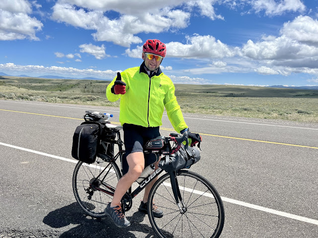
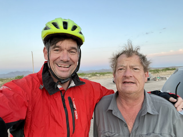
I crossed the Continental Divide once again, and was now on the Atlantic side. There was no road sign for documentation. I ran into Colin from Northwest England who was riding the TransAm for charity (Cardiac Risk in the Young). He was off the ACA route and fighting the brutal wind. He was thinking about going over to Saratoga and then down to Riverbend Camping, where I had been last night. His partner was behind him. Soon afterwards I met Steve, who asked if he was at the top of the climb. He unfortunately wasn’t.
I came to a ginormous downhill where I could see miles of flatland in the distance ahead. I hit 49.7 miles an hour, which was my bike’s new speed record. Seventeen miles out of Rawlins I noticed that I once again had phone and Internet service. There was a huge mesa to the northeast. At ten miles out of Rawlins the road became State Highway 71. Sheep Mountain Stood to the north and I noticed cell phone towers. I could see oil jacks to the west, as well as a large snow fence.
Five miles out of Rawlins I could see buildings. The wind was making dictation difficult, even when my phone was pressed against my face. The wind was so severe that I was blown off the road into the gravel four times. My frame bag and panniers were acting as sails.
I passed large tanks, pipes, and petroleum infrastructure on my way into town. I could see Interstate 80 stretching across the horizon. I entered Rawlings population 8,221 and elevation 6,755’. I rode past trailer homes to Abuelita’s, where I ordered a few margaritas, Dos Equis, a plate of enchiladas with chicken, chips and salsa, and an order of beef tacos. I edited today’s report in the warm restaurant while the Mexican music played. It was forecast to go down to 36° F tonight.
 |
| My cabin mate ‘Buck’ on the other lower bunk |
 |
| My $15 cabin at Riverbend Camping in Slater, CO |
 |
| Riverbend Camping In Slater, CO |
 |
| State Highway 70 out of Slater |
 |
| English TransAm cyclist Colin |
 |
| English TransAm cyclist Steve |
 | ||
R is for Rawlins
|


Comments
Post a Comment