Great Divide (NOBO) - Day #17 Steamboat Springs, CO to Slater, CO
Great Divide (NOBO) - Day #17
June 13, 2022
Steamboat Springs, CO to Slater - 68 Miles
Start 8:33 AM Finish 5:50 PM
Total Duration 9:17
Moving Time 7:39
Stopped Time 1:38
Ascent 5,257 Feet
Descent 5,407 Feet
Tour Total 1,211 Miles
Details at: https://ridewithgps.com/trips/93345107
I slept great last night in room 211 at the Nordic Lodge in Steamboat Springs. Last night Sam, Scarlett, and I had an amazing dinner at Laundry. It was so good to have taken a day off and give my sore body a break. I woke up this morning with the sun and began packing. Sam and I walked over to the Creekside Cafe, where I enjoyed a cappuccino, orange juice, and a bowl of granola, fruit, and yogurt. I took the Yampa trail out of town and then got on Elk River Road aka. County Road 129 heading north. It was asphalt with not much of a shoulder. I passed numerous signs telling motorists to give cyclists three feet of space when passing, and there was a fair amount of motor traffic. I was now following the Elk River upstream, and there wasn’t a single cloud in the sky. I was wearing my short-sleeve shirt and cycling shorts.
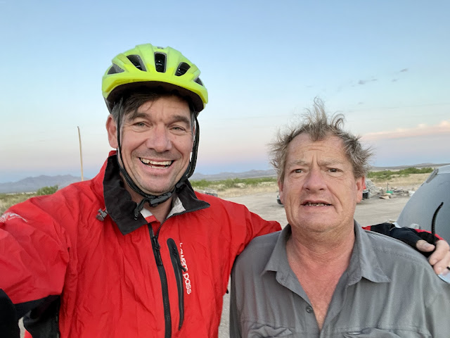
After seventeen miles I ran into southbound divide cyclist Lauren from Denver, who pointed out that I had a tail wind. She was riding from the Grand Tetons to the New Mexico border. She hadn’t seen any northbound cyclists for a couple of days, and had taken the Columbine alternate route on this section. She told me that camping alone made her nervous. She was afraid of things that brushed her tent in the night. Ryder had mentioned that he was afraid of bears, and said that one had once sniffed his tent. I heard from him yesterday, and he was off to Bolder to see a Grateful and Company concert.
I rode into Clark, no population listed and elevation 7,271’. I stopped at the Clark Store which was the general store, deli counter, liquor store, post office, and library. It was the local hub and was full of activity with locals and travelers like myself. I was still full from breakfast and all I got was a Pepsi. The guy at the cash register was a character, and said that there would be nothing going north for the next hundred miles. He told me that as soon as the racers came through, the route would be thick with cyclists going in both directions. I asked him about the snow on the Watershed Divide, and he replied that the conditions could change at any moment. I took a left on County Road 62 and crossed the Elk River. Soon I was on dirt heading up into the hills.
I passed numerous handsome ranches. The impressive architecture was matched by the equally bold entrance gates. I was again passing fields full of dandelions and yellow mule’s ears. I was listening to a WFMU Duane Train file and enjoying my tail wind, and eventually realized that I had missed a turn. I had accidentally started the Columbine alternate route. After all of the detours and alternate routes in New Mexico I intended to stick to the main route for the rest of the tour. I turned around and battled the wind to get back to the main route.
Earlier I had mistaken Mill Creek Road as a ranch entrance. It was narrow, sandy, and badly rutted. The alternate would have been much easier, with less climbing. I’m a masochist, what can I say? I came to a locked gate across the road with a sign that read ‘Road Closed’ ‘Seasonal Closure for motorized vehicles’. There was a narrow path around the gate and I continued on. I had heard on the Facebook group that this road had been covered with snow a week and a half ago. Cyclists were having to walk five miles through snow. I believed that it would all be melted by now. We would soon see.
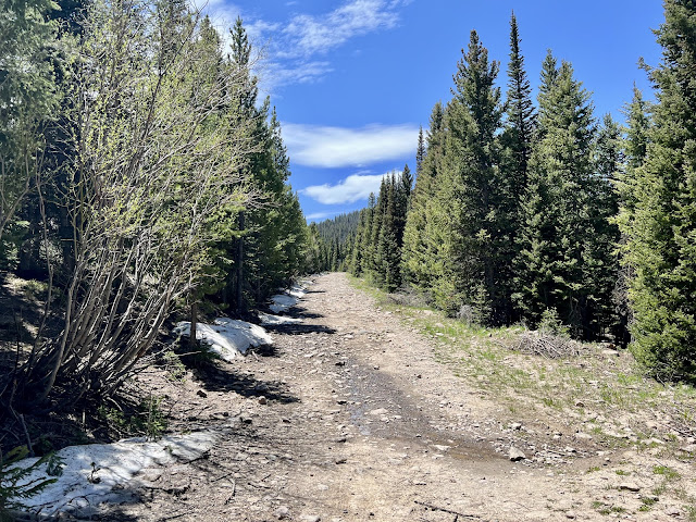
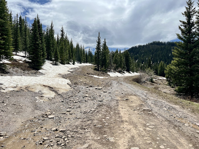
Now I was really out there. There were no more ranches, no more utility poles, and no cattle. There was only fir and aspen trees, grass, dandelions, rocks, sticks, and the cloudless sky which was vivid blue. The road was incredibly chunky and it was a steep uphill. I began passing piles of snow to the side of the road. I had to take a lot of breaks on the steep chunky section, and even had to hike-a-bike a few times. The steep chunky finally ended. It became a more mellow grade but the surface was still chunky. Small piles of snow were in the road that I had to ride through. The sun was bright so I pulled over and put on my arm protectors. The melting snow had turned the road into a creek, and my tires did well in the mud. Two guys passed me on ATV’s going in the other direction. Towards the top I encountered several long sections of snow that I had to hike-a-bike through. There was also a downed tree that I had to walk around.
I finally reached the Watershed Divide and it was time for the downhill, which was much easier with the big chunky rocks, melting snow, and mud. There were a lot of downed trees in this area, and the sky had gotten cloudy. I came to a gate that was open and there was the same Seasonal Closure sign that I had seen earlier at the locked gate. I was now out of the bush, and the road became much better. The surface was smoother and without large chunky rocks. I passed a camping area where I noticed an RV and a motor vehicle. Trevan’s crash on day number two had affected me. It was a vivid reminder that it’s possible to get hurt out here. If I crashed in a remote area with no traffic (with an easier alternate detour) I could be stuck out here for days before anyone found me. I was making good time on the downhill, and making up for the slow climb.
I came to National Forest Road 150, which was much wider and had smooth dirt and gravel. I saw an antelope bouncing across the road. The sky remained overcast and the wind was strong. It was getting chilly. By 3:30 PM I had gone forty-six miles and I was leaving the Routt National Forest.
I was now following the Slater River downstream and noticed a couple of deer along with dozens of reddish-brown groundhog-looking critters. I passed an abandoned snowmobile on the side of the road, and also a large piece of construction equipment used for scraping and smoothing the gravel road. I crossed the river and the wind was intense. I was cold, so I stopped to put on my jacket.
At 4:30 PM I came to Brush Mountain Lodge where, in years past, there had been lodging and camping. There was a collection of buildings along with utility poles, and for a moment I was back in civilization. I had pedaled fifty-four miles. I later passed herds of cattle and large grassy fields being watered.
I was riding up and down along the side of the ridge following the Slater River. At one point I dipped down into the valley and came to the intersection of County Road 38. It was 5:12 PM and I was six miles from my destination. I crossed back over the river and went through a narrow canyon. I crossed the Slater once more. I could see State Highway 70 ahead and then I crossed the Little Snake River. The sun had come back out, and I took a right on highway 70.
The town of Slater consisted of a few buildings and a post office. There were no services. I passed the Wyoming border sign and then left the highway as I pulled into Riverbend Camping. Rick the proprietor offered me a cabin for $15. He said the mosquitoes would eat me alive if I camped. He mentioned that there was a northbound cyclist named Don who was two days ahead of me. Rick offered me a cold Dr Pepper, and I went and took a shower. My bike, feet, and sandals were covered with mud. I sat inside my cabin editing this report, before eating some refried beans. It was cold outside, and I closed all of the windows. There were two sets of bunk beds in the cabin, and I chose the left bottom bunk. On the right bottom bunk was a taxidermied deer head whom I nicknamed ‘Buck’.
 |
| Southbound cyclist Lauren from Denver |
 |
| The Watershed Divide was closed to motorized traffic |
 |
| The tour's third state |


Comments
Post a Comment