Great Divide (NOBO) - Day #11 Del Norte, CO to Luders Creek Campground, CO
Great Divide (NOBO) - Day #11
June 6, 2022
Del Norte, CO to Luders Creek Campground, CO - 68 Miles
Start 9:49 AM Finish 8:28 PM
Total Duration 12:39
Moving Time 8:39
Stopped Time 3:59
Ascent 5597 Feet
Descent 3443 Feet
Tour Total 802 Miles
Details at: https://ridewithgps.com/trips/92540112
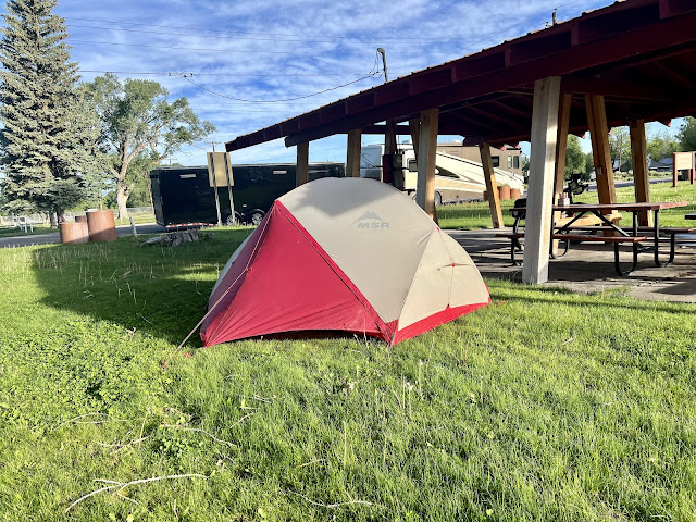
It rained last night and I stayed dry and warm inside my tent at the city park in Del Norte. My bike was underneath a picnic pavilion, and all of my derives had been left out to charge. When I awoke, I was frustrated about loosing my reading glasses. I was also upset that the bike shop was closed on Mondays. I gave my rear wheel a look over and tightened a few spokes. I rode back to the brewery but they didn’t have my reading glasses. I then went across the street to Boogies for breakfast, where I ordered eggs over-easy with bacon, hash browns and a pancake, along with orange juice and coffee. I sat there until yesterday’s report was uploaded.
I rode over to the Family Dollar and bought myself a new pair of reading glasses. Then I cycled back through town and took a left on State Highway 112 and crossed over the Rio Grande river. I made a mistake and took the wrong road out of town. I finally got it all straightened out and ended up on Rio Grande County Road 15. I was still on pavement, but it soon ended. I took a left on County Road 22 which was gravel. There were signs and arrows for the Great Divide Mountain Bike Route, the first I’d seen on tour. Essentially I was riding around the Del Norte airport. I could see single engine planes taking off and landing.
It was dry here, and there wasn’t much to either side of the road except clumps of grass, scrub, dirt, and rocks. I was following a pair of bicycle tracks and wondered how far ahead the riders were. I had a feeling that I would catch them today. It was mostly cloudy, which was protecting me from the scorching sun. The sand at times was thick, and giving me troubles with the occasional foot down. The headwind was keeping the biting insects away.
I came to County Road A32 and took a right. I was following the other bike tracks but would occasionally double check my digital map. I saw a turn-off for a natural arch but didn’t want to go to several miles off route.
It started to sprinkle as I pedaled out of Rio Grande National Park. I passed the purple people ranch decorated with purple rocks at the entrance and stacks of purple rocks around the ranch perimeter. The track that I’d been riding eventually turned into a proper gravel road with occasional washboards. It eventually became two lanes. I came to T with an actual stop sign. I took a left on gravel and sand County road 38A towards La Garita. I noticed a large range to the north, and was currently at 8,000’ elevation.
I rode into La Garita and went to the Cash Store. Out front were two gravel bikes, and I met Luke and Chris inside. They recommended the homemade cookie and cream ice cream, so I got a cone and a bottle of Coke. The friendly proprietor was interested in my trip and wanted to know about the Adventure Cycling Association, and what kind of refried beans I was traveling with. He wanted to hang a couple map sections on this wall and sell beans to other riders. I got back on the route and was on Saguache County Road 41G. The pavement ended at Hell Gate.
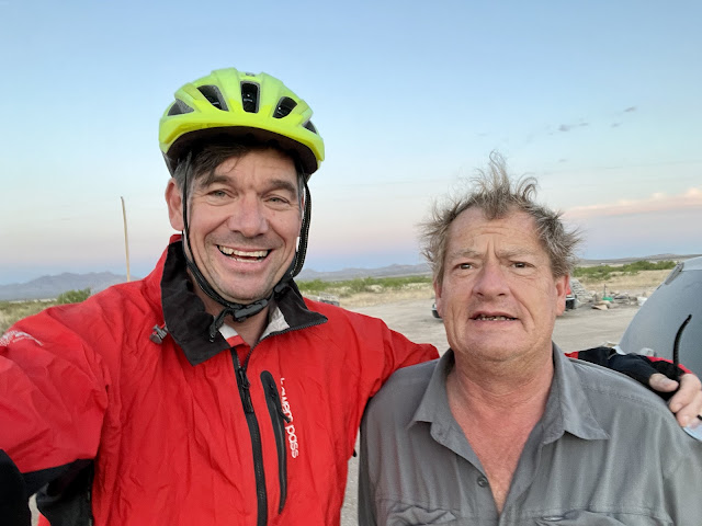
I was riding up a valley carved by the middle fork of the Carnejo Creek, and startled CDT through-hiker Dallas when I announced myself. She had started April 9th. I caught back up with northbound cyclist Chris, whom I’d met briefly in la Garita. He hailed from Key West, FL and had started his tour in Tucson. He had ridden parts of the Divide before, and had originally met Luke going in the other direction. They were originally planning to cycle a different trail but couldn’t because of the fires. He said that the college students were ahead of them and were trying to get to the Canadian border by July 1st. The college students were doing 65 miles a day and were packed heavy. He thought that I might catch them. Chris and Luke had stayed at the RV park in Del Norte and had seen me last night at the brewery.
There had been a light drizzle throughout the day, and then all of a sudden it let loose. I tried to get my rain jacket out of the compression sack as fast as possible, without letting water into my pannier. My phone screen doesn’t respond when there’s water droplets on the glass. I ran into Magic Mike from Northern California who was hiking the trail. I caught back up with Luke at Storm King campground. He was from Amsterdam, and was filling a gap on the southern part of his Great Divide tour. He was able to wait out the rain shower in a bathroom at the campground.
I kept climbing past beautiful rock walls and groves of fir trees and Aspen. I could hear the gurgle of the creek below. I passed the Carnaro guard station and was only about a mile from the pass. I summited 10,166 foot Carnero Pass at 4:52 PM, and started to rain again. I had ridden 41 miles. It was cold on the descent and I thought about adding extra layers. An elk ran across the road and I was startled by a bunny.
I came to a valley with buttes similar to what I had seen when I first began the pass, and then I left Rio Grande National Forest. The sun came out for a moment and then it went away. I got to State Highway 114 and took a left heading west. There were dark clouds to the west, and it looked like a storm. I had a headwind on the highway. I turned on my rear tail light but there was hardly any motor vehicle traffic. I had a nice shoulder and there were cattle in the fields to the right. I saw a family of white tail deer jump over a fence and run across the road. They left behind a little one who couldn’t make it over the fence. I had no service and could definitely see rain to the southwest.
I left the highway and took a left on gravel County road NN14 towards Rabbit Canyon. My destination, Luders Creek Campground, was eight miles away and it was 6:26 PM. I entered back into the Rio Grande National Park as it started to sprinkle. I was headed west straight into the sun, which was still well above the ridges and tree line. The rain eventually stopped and I kept climbing. It was slow going at four mph on the gravel uphill. Soon I was once again surrounded by fir and aspen trees.
The sun went behind the trees at 7:30 PM and I put on my clear goggles. I passed the intersection for National Park Road 768 that went to Taylor Canyon. My destination, Luders Creek Campground, was three miles away.
I reached Windy Point at 7:50 PM, and it lived up to its name. I was two miles from the campground. I noticed a sign with an arrow, and assumed that it was the campground. I followed the dirt track and could see on my digital map that I was off route. I was tired and hungry. I finally figured it out and reached the campground. I selected site number one, directly across from the bathroom. I got set up in the gravel before dark. I finally sat down at the picnic table and relished my refried beans.
 |
| City park in Del Norte, CO |
 |
| Del Norte, CO |
 |
| CDT through hiker Dallas |
 |
| Northbound cyclist Chris from Key West, FL |
 |
| Northbound cyclist Luke from Amsterdam |
 |
| Through hiker Magic Mike from Northern California |
 |
| Map/Elevation Profile |


Comments
Post a Comment