Great Divide (NOBO) - Day #3 Silver City, NM to Willow Creek Campground, NM
Great Divide (NOBO) - Day #3
May 29, 2022
Silver City, NM to Willow Creek Campground, NM - 92 Miles
Start 6:19 AM Finish 8:38 PM
Total Duration 14:18
Moving Time 9:35
Stopped Time 4:44
Ascent 8,026 Feet
Descent 6,139 Feet
Tour Total 223 Miles
Details at: https://ridewithgps.com/trips/91759932
I had a snafu last night when I left the brewery and went to the RV park. It was after hours and I had to call a phone number posted in front of the office. The woman who answered told me that the campground was full. It was Memorial Day Weekend and there was a blues concert and various festivities in town. I went to a gas station and filled all my water bottles. I turned on all my lights and peddled out of town on Highway 180. Keeping my eyes peeled for stealth camping options, I passed an RV mobile home park advertising 'RV’s welcome! A very peaceful place to live'. I turned off my headlight and rode down into the park. I saw two abandoned trailers and found a nice even pitch of grass behind one of them. I set up my tent with my stealthy red headlamp. The air was still and I didn’t use my tent stakes. I’d have to keep track of how many times I used them. The gps data for the extra 4 miles was: https://ridewithgps.com/trips/91557812
I tossed and turned throughout the night and suffered a terrifying stress dream. It was a slow methodical pack up this morning. It was a different routine with the new set up. It was slower but perhaps more efficient. It had always been an ordeal whenever I forgot to pack my headlamp or ground cloth with the old rack pack set-up. With the new frame bag it was easy to stick things into the side pockets. There no longer needed to be a packing order. Before I departed I also put my Liv Ratchet set and crescent wrench into the tool and spare parts bag, which I kept in my rear left pannier. The rattling Liv Ratchet set was driving me crazy yesterday on the bumps.
I was having trouble last evening with my Wahoo, and I couldn’t call up the Black Canyon detour route. Because of the Gila wildfires, ACA had created a detour route on Ride with GPS. I had the files on my phone and I thought they were on my Wahoo. The files were listed on the Wahoo but I couldn’t get them to load. I fussed with it last night in the tent and believed that I needed Wi-Fi to straighten it out. I also changed the password on my phone because the facial recognition unlock wasn’t being cooperative. I wish that I could just leave my phone unlocked. It took too many steps while I was riding.
I headed out of town on Highway 180 W, and passed the truck bypass to Highway 90. The winds were forecast out of the west today, so the earlier the start the better. The highway was paved, and I would be getting a meal in Alma before going off-road. The dirt road would eventually get me back to the route. The air was clear, and there were wispy clouds in the sky. I was wearing my jacket and leg warmers. Silver City's catchphrase was 'The Gateway to the Continental Divide'.
I wondered what happened to Otso & Nora last night. Certainly all the Silver City hotels were booked. Maybe they got to the RV Park before it filled. Maybe they met up with a trail angel. I documented my second Continental Divide crossing road sign. I was at an elevation of 6,230’. I entered the Gila River watershed. The Gila flowed into the Colorado river.
I was no longer in the flat desert. The hills began to roll and it was entirely different from the past two days. I passed a motor vehicle crash site memorial, with the name BOOMER spelled in large white rocks. I heard back from northbound cyclist Mark who was a few days ahead of me. He had taken highway 180 north and then highway 12 east to Pie Town. This had been the easiest route. It was all paved and the tour was supposed to be about dirt, gravel, and climbing.
I passed a CDT hiker heading north and stopped and to talk with him He was wearing AirPods and was in another universe. I asked him if he knew about the fires, and he asked, “Fires?”. He did’t even know that he was in Gila National Forest. He was uncomfortable and walked away.
I crossed over Black Smith Canyon. The term canyon was used here to denote stream, and it was bone dry. After crossing the ridge, the land open back up and everything was on a larger scale. The mountains ahead were formidable. I came to the junction of State Highway Highway 211 and crossed over the Gila River, which had a nice current of green water, ten feet wide and two feet deep. In Cliff I stopped at Chuck’s Foley where I got a Black Stag Iced Latte, a Minute Made Orange Juice, a Gatorade Thirst Quencher Red, and a Market Sandwich Italian Style Sub.
After breakfast I continued west on Highway 180. The flags alongside the road demonstrated what I already knew. I had a headwind. It was coming out of the southwest and I would have it in my face for the next twenty miles. The strong winds out of the southwest had been carrying the forest fire smoke away from me. I wouldn’t even know that there was a large forest fire so close. By 9 AM I had gone thirty miles.
The next town was Buckhorn, where there was a post office. I sat out under the portico to update my socials and write a postcard. On my way out of town I passed the Last Chance Liquor Store and a couple of roadkill skunks. I was prepared for a long hard slog to Alma, so I pulled over to plug in my iPod. I then realized that both of the earBuds that I had packed had lightening jacks. My iPod Nano required an 1/8” mini. Fortunately I had a few WFMU files on my iPhone so I listened to a bouncing BLT fill-in with my lightening jack earBuds.
A little ways down the road I passed the turn off for Highway 78. There was a lineup of construction equipment, as well as road signs for nearby towns in Arizona. I enjoyed a brand new section of asphalt that had just been laid. There were no yellow or white lines and it was smooth. I entered the Gila National Forest, and crossed over the Big Dry Creek, which lived up to its name. I crossed the Catron County line and lost the new asphalt.
I heard from Trevan. The X-rays showed a clean break and no surgery was needed. The bones were aligned and would heal on their own. Here’s a link to his blog: https://www.cycleblaze.com/journals/ismybikeok/
A few miles later I crossed over the South Dugway Canyon, and after a gorgeous downhill I crossed the Red Colt canyon. I climbed up onto a ridge and then enjoyed a beautiful descent past chiseled brown rock formations. I entered Pleasanton where there were a few houses and ranches. I passed over Holt Gulch and then Shelton Canyon.
On a long uphill I pulled over to the side of the road to enjoy some water under the shade of a tree. I then rode into Glenwood which boasted a post office and several businesses including a hotel, gift shop, and liquor store. None of them appeared to be open. There were many cars parked in front of the church and the cafe had long been closed. There was a stream that ran through the town and the center was shaded by trees. I stopped at the Glenwood trading Post for a Coke on ice and a Mrs. Klein spicy dill pickle - which was plenty spicy!
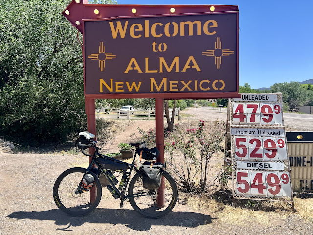
I came to the turn-off for Highway 159 which I would later be riding for the detour. I stopped to read about the mining ghost town of Mogollon, and then continued west to Alma for lunch. I rode down a huge hill that I would have to make up after eating. I would need to charge my phone before returning to the detour.
There was a Turd sign in front of the cafe. I hate supporting businesses with these signs. I ordered huevos rancheros, chips and salsa, and two bottles of coke with ice. The total came to $28. Last night’s dinner in Silver City had been $55, and had included two entrees and five pints of beer. Hmmm.
A group of noisy senior locals were in the back of the restaurant alongside me, and I asked them if they were familiar with the area in regard to the Black Canyon fire. I showed them my paper maps and Ride with GPS detour. They assured me that I would be fine. I would be north of the fire and away from the closures. They teased the way I pronounced Mogollon. I wasn’t sure when I would next have services or even be able to find water, so I topped off my bottles. I climbed back up the hill eastbound to the turn-off for Highway 159, and then took a left. I was immediately greeted with all sorts of warnings signs about snow, plowing, steep grades, and sharp curves. I was still on pavement. There was very little traffic and no shoulder.
I had a nice tailwind, and wanted to bang out as much of the detour as possible. It was open range and there were cows all over the place. I came to a sign that read ‘Caution One Lane Road Next 5 Miles’. It was steep 14% grade and I was in my lowest gear. The cool wind felt good on my back as I climbed up the ridge. I took several water breaks in the shade.
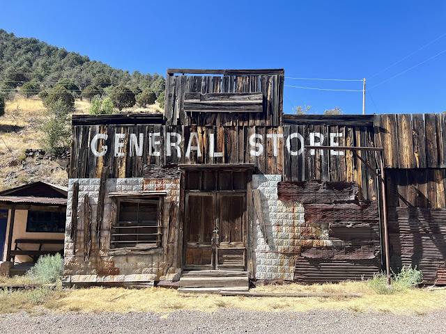
I passed mile marker seven at 6,920’ elevation. I was still on asphalt and began to notice more pine trees. And then I came to a nice curvy downhill into a valley on the other side of the ridge. There sat the pleasant old mining town of Mogollon. I went to the Purple Onion for two cold cokes and some air conditioning. They had wonderful food available and I regretted riding into Alma. I also realized that I had left my coin purse back at the cafe.
I topped off my water bottle with ice water before I left. The pavement ended on the far end of town. I was still on Highway 159 East / old 78, and also known as Bersum Rd. As I continued further along the gravel I saw signs warning of dangerous conditions, such as avalanches and flooding. Much of this had to do with the 2012 forest fire, and I could see evidence of the blaze. I was enjoying the shade of the pine trees and was crossing small streams. My bike was handling great as I rode atop crushed gravel and rocks. The gnats were driving me crazy so I pulled over to spray my face with OFF.
My bike and new tires were handling the gravel extremely well. There was no slippage or spin out. I never lost control and there were no foot-downs. I was becoming confident. I stopped in the shade on the downhill as a motorist passed me. They were in a medium sized car and the passenger asked if I knew the area or if I had ridden this route before. They weren’t sure whether they could get through or not. Because of the grade and large chunky rocks it was more of a risk for them. It was nice to have the advantage for a change
I climbed up rough steep switchbacks with chunky rocks and loose gravel. I had a near wipe-out and took breaks as I panted out of breath and guzzled water. I could tell from the maps and the land profile that I was nearing the top. The gravel surface improved and the grades mellowed. It’s always more chunky and rutted on the steep grades. I was really appreciating the cool breeze against my back. I was now hoping that my destination for tomorrow would be Pie Town, where I could stay in the toaster house and eat pie. I had read that the Pie cafes were closed Tuesday so this might work out for me. In addition, I would be a half a day ahead of my itinerary.
By 6:51 PM I had reached the top of Silver Creek Divide. I was at 9,120’ elevation and I had a nice flat section on top of the ridge. Hopefully I would soon get to a nice downhill to a lovely campsite. Dust was blowing around up top so I pulled out my buff so I didn’t have to breathe it. I reached Sandy Point, elevation 9,130’. There was an outhouse and it was indeed sandy.
The ridge lasted for much longer than I expected. I rode chunky downhills and chunky uphills. I was really enjoyed my new bike. I could slam right into large rocks with no effect. I could do things that I would never do on my Surly. I was trying different finger combinations on the brake levers and grips on the handlebars. I came to an overlook where I could see a large empty grass plain to the east. The trees were sparse, probably because of wildfires. The ground was covered with yellow-green grass.
It was after 8 PM and I needed to get down into a valley to sleep. It was too windy up top and soon it would be cold. I removed my sunglasses, and then pulled over to put on my jacket and leg-warmers. I spotted an elk in the woods. It was starting to get chilly. I spotted a grassy area down below with a wooden structure. I reached a T and took a right to discover a campground. I crossed through a stream and stopped next to a picnic table. I set up my tent, hung my food from a tree, and went to bed. It had been a long day.
 |
| Stealth camp spot outside of Silver City, NM |


Comments
Post a Comment