Great Divide (NOBO) - Day #33 Seeley Lake, MT to Cedar Creek Campground, MT
Great Divide (NOBO) - Day #33
July 1, 2022
Seeley Lake, MT to Cedar Creek Campground, MT - 78 Miles
Start 7:55 AM Finish 6:30 PM
Total Duration 11:35
Moving Time 8:29
Stopped Time 3:06
Ascent 5,751 Feet
Descent 6,472 Feet
Tour Total 2,413 Miles
Details at: https://ridewithgps.com/trips/95274617
Last night at the Chicken Coop & Lounge in Seeley Lake I enjoyed several pints of Hazy IPA along with the chicken dinner and chicken strip salad. The wall outlets were loose and it was challenging to recharge my devices. I kept unplugging one of the beer signs and I felt self-conscious. After dinner I stopped at a Conoco station for two cans of Sierra Nevada Summer Ale and a bag of Fritos. Then I rode over to USFS Big Larch Campground where I set up my tent at hiker-biker site B2. I slept well through the night and it didn’t get as cold as past nights. It was relatively quiet and there was a slight drizzle when I got up in the middle the night. There was a lot of condensation in the tent this morning, and I rolled up a wet tent. I packed up and rode back into town. Seely Lake’s catch phrase was ‘Change your pace’.
I returned to the Conoco, which was doubled as an Ace hardware store. I was impressed with the selection of merchandise. I got an egg sausage sandwich, a Starbucks Frappuccino, and an orange juice. I sat inside with the local retired guys. I checked the weather forecast and saw that a brief shower was forecast early this morning. I decided to hit the road anyway. Seeley Lake was a few miles off route and I had to return to the woods. I took State Highway 82 back to Seeley Creek Drive and then back to the turn-off that I had passed yesterday.
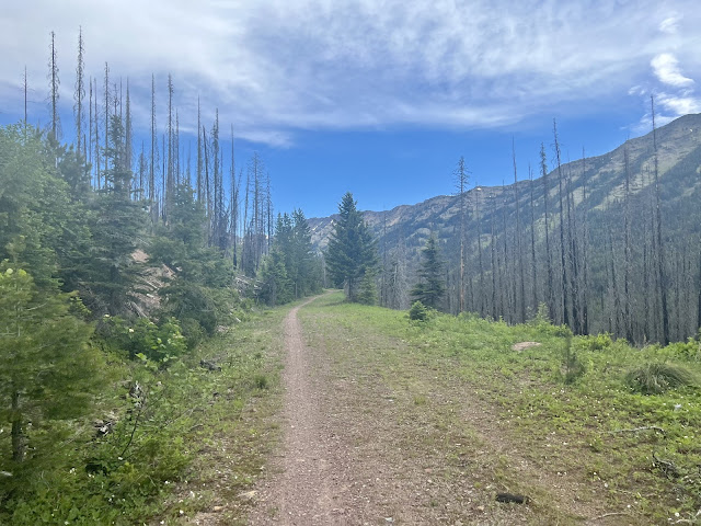
The sky had gotten dark. I stopped to fold my map and the system seemed to have passed to the east. I came to the turn-off and then took a left on Morrell Clearwater Road, aka County Road 4353, which ran along Morrell Creek. I had a big climb this morning and had heard reports of snow and slippery ice. State Highway 83 offered a direct route north, but I stuck to the gravel route which meandered up and over a ginormous pass. I rode through a large burn area, and then the sun came out. The dirt was smooth and the grade wasn’t too bad.
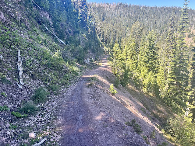
I came to a fork and took the left track, which was a steep cut along a ridge towards the pass. I stopped to remove my leg-warmers and jacket, and apply sunscreen and my arm protectors. Morrell Creek was now far below me. The road turned to two-track and got chunky. Eventually the green fir trees returned and it was beautiful riding past wildflowers and bears grass. And then I came to the single-track Swan Divide Trail. A green snake in the path quickly slithered out of the way.
The old logging road had been cut into the side of the ridge, and had later been closed off at both ends to prohibit motor vehicles from entering. Trees had taken root, which made the track tight and narrow. And then it began to get chunky. I started passing piles of snow and it began to get steep. I had to hike-a-bike a few sections. I found somebody’s bike shorts, which I picked up and bungeed to my rear rack. I’m not the only cyclist who looses things. I rode through another burn area and then topped Swan Divide aka Summit Pass. There had been a landslide in one place, and the path was narrow with a terrifying steep drop. I had to walk over a few snow drifts, where I ran into Aaron and Janet from Colorado Springs. They were doing the route from the Canadian border to the Colorado-Wyoming border. They had seen a bear this morning, and warned me about a grizzly that another pair of cyclists had seen in a campground.
I rode over a couple more piles of snow and went around a bend to relish stupendous views of the ginormous Swan Range across the valley. The downhill began and a black dog came running towards me. I skipped a heartbeat thinking it was a bear, and a hiker apologized. I eventually returned to dirt road 4353. I enjoyed a nice downhill and passed a female south-bounder taking a break. I later passed her partner. I took a right on 4370.
Down in the valley I admired the towering Swan range to my right. The range to my west was called the Mission Mountains. I passed a male and female pair of south-bounders. I came to a gate and went around it. I had a nice downhill and came to State Highway 83, and I realized that I made a wrong turn. Instead of continuing north to Holland Lake, I had gone south and had back-tracked. My starting point, Seeley Lake, was only fourteen miles to the south from here. I took a right on State Highway 83. I passed a plaque about the Swan Massacre of 1908, when a local game warden shot and killed a number of Native Americans who were legally hunting. After a few miles I came to Holland Lake Road and was back on route. My plan was to head to the Hungry Bear restaurant, which was a mile off-route from the next turn off.
At the Hungry Bear I ordered several pints of HUCK IT Huckleberry Blond Ale from Big Sky Brewery in Missoula. For lunch I got a Huckleberry Blueburger and fries, along with the Huckleberry Cheesecake for dessert. I picked up a six pack of HUCK IT for the road and left the bike shorts at the lost and found. I then rode back to the route and turned right on County Road 561 aka Kraft Creek Road. I had thirty-three miles to my destination at Cedar Creek Campground.
I took a right on Elk Creek Road aka County Road 9591. The road meandered through the forest and eventually became two-track. I enjoyed another nice section of single-track where large boulders prevented motor vehicles from entering. I noticed many dried bike tire ruts, and I could see how muddy it had been when the racers came through. I came to a big downed tree across the road and had to lift my bike over it.
I took a left on Peck Lake Road, aka County Road 888, and rode through the fir trees and bear grass. I passed two south-bound divider dudes. I came to a T and took a left on 966. I was eleven miles from my destination. I had traveled sixty-six miles and it was 4:55 PM. I crossed Cedar Creek and took a right on County Road 10381, which was narrow and soon turned two-track. I stopped for a moment on a small bridge crossing the Fatty Creek, and got a contact cool-down from the cold white water below. I came to a T and took a right on a chunky downhill. The waterfalls were amazing on this section. I came to a wider gravel road and took a right on a smoother downhill.
I left the route to ride down into the Swan River Valley, where I would be camping. I crossed Fatty Creek and pulled into the primitive campground. There was a family of rednecks whom had established a camp constructed from blue tarps. One of them was washing their dishes in the creek when I arrived. I set up my tent and cooled my beer in the creek. A police officer arrived and we talked about grizzly bears and bear bags. The redneck family made a loud commotion as they packed up and left. I sat at a picnic table and enjoyed Beanee Weenies, tortillas, and cold huckleberry beer.
 |
| Hiker biker site B2, USFS Big Larch Campground, Seeley Lake, MT |
 |
| Red poppies |
 |
| Mariposa lilies |
 |
| Burn area on Morrell Clearwater Road, aka County Road 4353 |
 |
| Swan Divide Trail |
 |
| Swan Divide Trail |
 |
| Washed-out section |
 |
| Swan Range |
 |
| Well deserved Huckleberry Blueburger and fries at the Hungry Bear, Condon, MT |
 |
| Well deserved Huckleberry Cheesecake at the Hungry Bear, Condon, MT |
 |
| Gorgeous section |
 |
| Downed tree across Elk Creek Road |
 |
| Gorgeous section of waterfalls |
 |
| Map/Elevation Profile |


Comments
Post a Comment