Great Divide (NOBO) - Day #29 Wise River, MT to Informal Campground 1
Great Divide (NOBO) - Day #29
June 26, 2022
Wise River, MT to Informal Campground 1 - 68 Miles
Start 8:10 AM Finish 8:44 PM
Total Duration 12:34
Moving Time 7:22
Stopped Time 5:12
Ascent 6,320 Feet
Descent 5,977 Feet
Tour Total 2,135 Miles
Details at: https://ridewithgps.com/trips/94746523
Last night I met Don at the Wise River Club where I ordered a few pints of Septer IPA by Draught Works Brewery. We met the partner of blind cyclist Jesse Shawn, who was riding the divide. I had a hard time wrapping my head around cycling these roads and this terrain with no vision. Their organization is called ‘Choose to See’. Jesse’s website is http://shawncheshire.org/ and her Instagram handle is @shawn_cheshire
I set up my tent in the grass behind the bar. This was the third bar that I’d slept behind on this tour. For $10 it included a shower in a what used to be a sauna. With my final beer the server had brought me a towel and small bar of soap. The mosquitoes were tenacious as I brushed my teeth and ran to my tent. It got cold during the night and I had to get up several times. The grass felt nice on my bare feet. I had dreams about Fleecer Ridge. The downhill ones were fun. I had an uphill nightmare where it was knee deep in snow.
In the morning my tent was soaked with condensation. I did a little sun drying, but not as much as Don. I’m a fast packer and I like to get going in the morning. Don had his tortillas with honey and peanut butter for breakfast. One of his tires had gone flat during the night, and he added more sealant and pumped it full. So far it was holding.
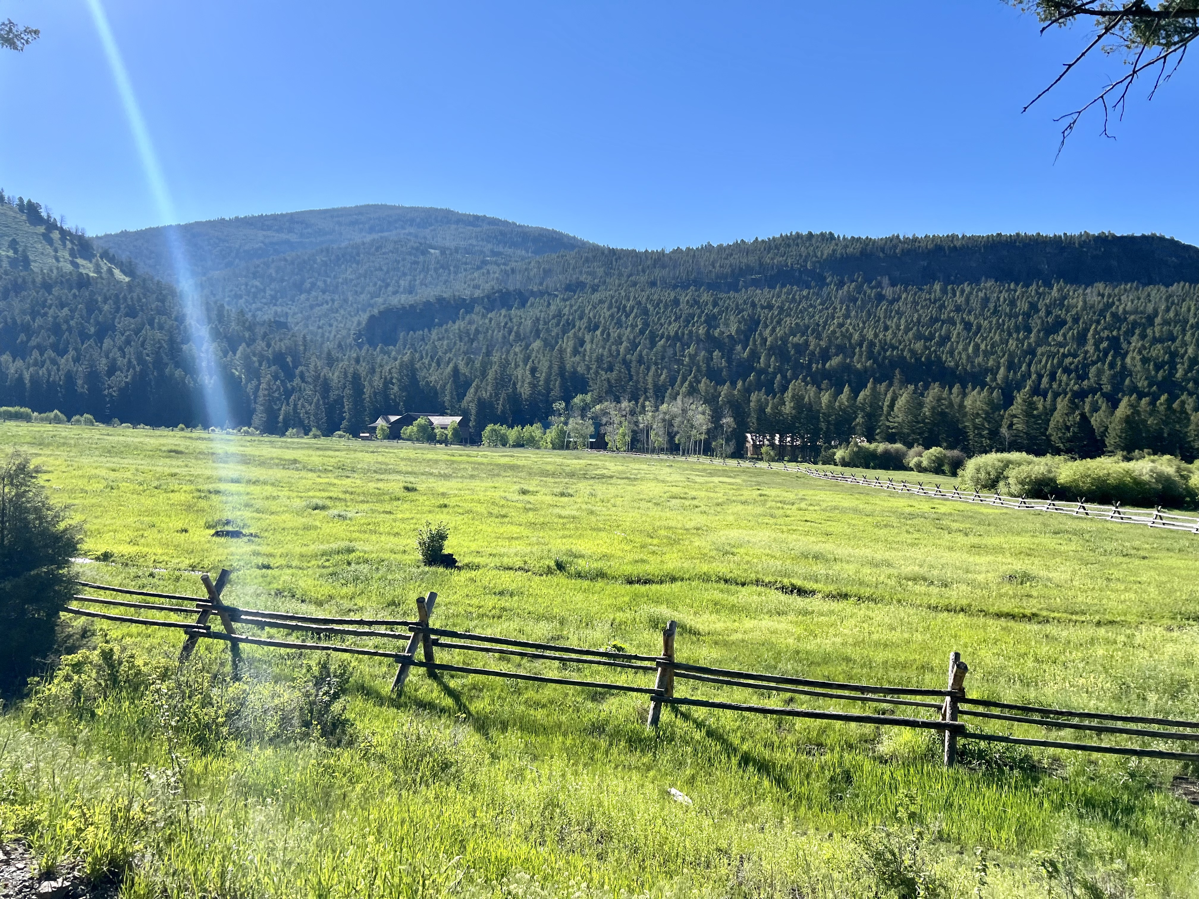
The sun was out and it was strong. There wasn’t a single cloud in the sky. This morning I would be cycling the infamous Fleecer Ridge, the most treacherous stretch of the entire Great Divide route. Don and I were doing it northbound which would be uphill, and I imagined a lot of hike-a-bike. We had heard that Andre and Gerda had hiked their gear up separately. Fleecer was the first thing out of Wise River, and I had planned to go all the way to Basin, eighty-eight miles away. Don would be cutting out in Butte to go visit his family. Andre and Gerda would be in Basin tonight.
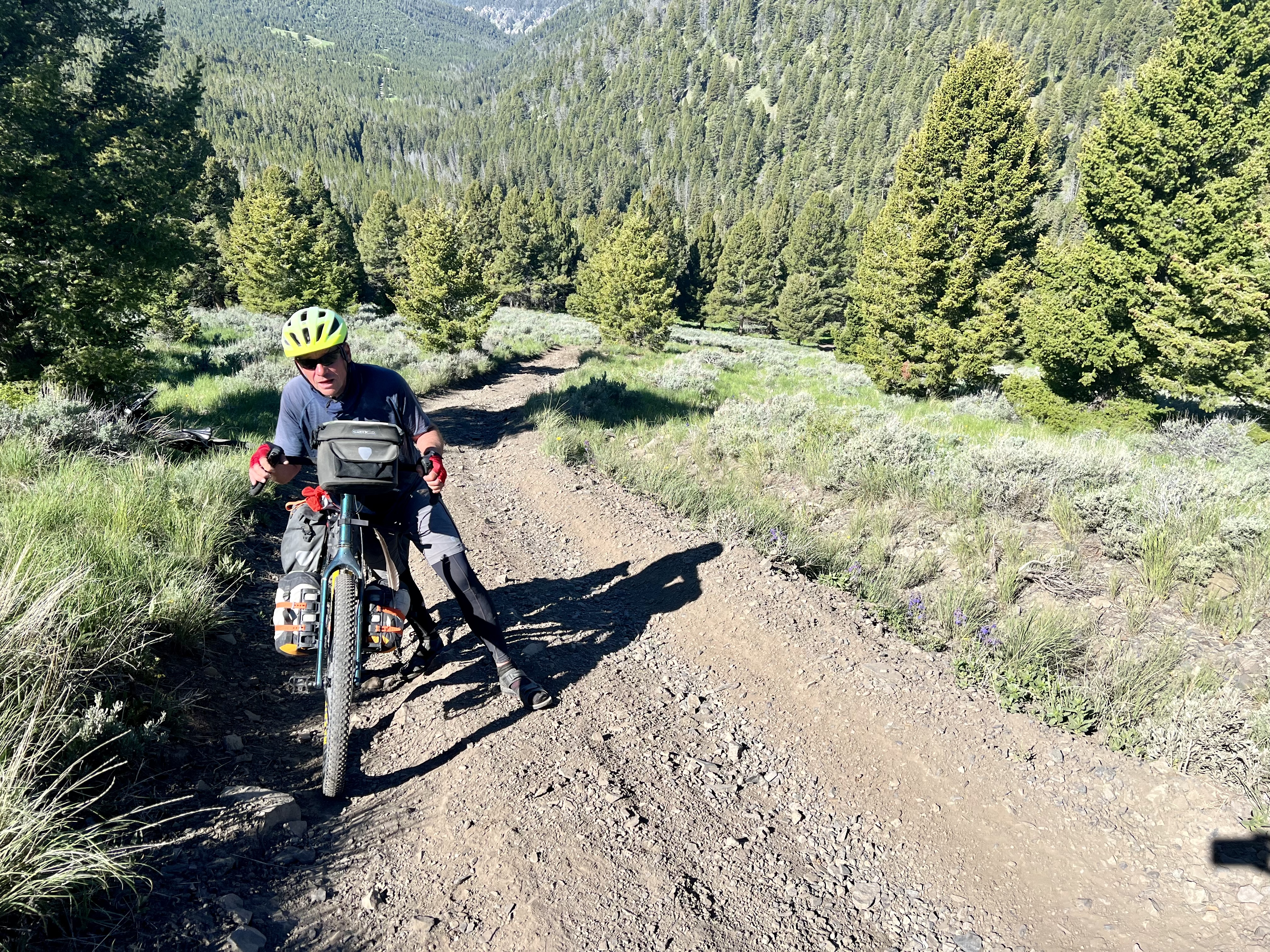
On my way out of town I stopped at the Wise River Mercantile for a Starbucks Frappuccino and two Rice Crispy treats. I met an ITT (individual time trials) Divide south-bounder inside, whose time was currently better than Sofiane’s. He told me that Fleecer wasn’t that bad. There was a guest book at the counter which I signed. I proceeded east on State Highway 43. The air was cold and I was wearing my leg-warmers and jacket, and I was chilly. I took a left onto gravel Jerry Creek Road, aka County Road 83. I crossed the Wise River and began the climb up towards Fleecer Mountain. Prairie dogs scrambled back-and-forth across the road as I steadily climbed. The road was steep and chunky with some two-track. There were ruts and a lot of big rocks. I noticed an oncoming cyclist and it was Don. He had missed a turn. The route was really chunky with snowmelt running down the tracks. I had to hike-a-bike through a rut and across a stream.
And then I came to Fleecer Ridge. I recognized it from photos and videos that I’d seen. It was the steepest climb that I’ve ever had to do, and over an hour of hike-a-bike. There were two different philosophies for getting up this monster. Andre, Gerda, and Don all pushed their bikes up without bags, and then went back down to retrieve their gear. I chose to keep my bags attached so that I would only have to make one trip up the mountain. Some of the sections were so steep that I couldn’t push my bike. Even with my brakes fully engaged, it kept rolling back down the hill. I positioned my bike perpendicular to the grade and stood uphill from it, as I lifted and dragged twelve inches at a time. I set five and ten foot goals for myself. The first part of the hill was the steepest, and the grade eventually began to level out towards the top. I tried to ride before reaching the summit, but was too tired. There were stupendous views up top. It was an amazing feeling of accomplishment to look down into the valley and realize that I had made it up this beast.
After the climb there was a short downhill and then nice gravel through meadows and fir trees. I came to a clearing where there were parked RVs and people sitting around a campfire. I took a left on County road 8486 and passed a south-bounder. I then passed another Divider. The downhill began, and I passed two more south-bounders. I was bombing down the hill and a woman in a white pick-up truck was flying towards me and didn’t yield. She came too close to Don and I, and it was an asshole move on her part.
I entered a wide valley. I was on Divide Creek Road and could eventually see Interstate 15 in the distance. A Fan Hill Crane swooped through the sky above, as I crossed a pair of railroad tracks. I took a right on Frontage Road which was pavement, and could see the next climb across the interstate. Highland Road was dirt and steep, and I went straight up the ridge. Unlike Fleecer, it was rideable. I stopped to flip my map, remove my leg-warmers, put on sunscreen, and plug in some music. While standing there, I was attacked by large black ants that were crawling all over me.
I finally reached the fir trees, beautiful round rock formations, and boulders. The route crossed paths with the CDT and I saw two southbound through-hikers. I was passed by a male and female pair of southbound dividers and I then rode by a remote camp set up with RV’s. I was climbing again and was passed by another male female pair. 7333’ Coyote Hill was in front of me and it still had a few patches of snow. I kept climbing past a small mining operation, and I then crossed the Continental Divide. I was now on the Pacific side. I bombed down the other side of the pass. Far to the west I could see a large strip mining operation. This area was once mined for gold and copper.
The pavement returned and I found myself on smooth asphalt Moose Creek Road. I then took a sharp left onto Roosevelt Drive. I turned onto the Herman Gulch trail which was amazing double track that led down through a notch. I then took a right on some incredible single track. This was the best trail that I’d ridden on this tour. Some of it was technical riding to avoid big rocks and boulders. I had one minor wipe out when I couldn’t unclip as I hit a rut in a creek bed, but it was no big deal. Towards the end of the single track there were large boulders, rock formations, and drop-offs, and I played it cautiously. I was on the Old Milwaukee Road, and ended up in Thompson park. I then took a gravel road down to State Highway 2.
There was a warning on the paper map about dangerous 60 mile an hour automobile traffic and S-curves. It was advised to ride carefully so I turned on my rear tail light. I came to a white cross with a bicycle icon. Montana marks traffic fatalities with white crosses, and this was the first bicycle white cross I’d ever seen. I turned onto state highway 375 also known as Continental Drive. As I was nearing Butte, I noticed someone on the side of the road who looked like Don. His brother, Brady, had arranged to pick him up and drive him back to Bozeman for a couple of days. Brady told me about the thousands of miles of copper mining tunnels beneath Butte. Copper had been discovered here about the same time as electrical wiring began to flourish back east, and Butte became a boom town. Don and I said our goodbyes and I continued into Butte.
I noticed Our Lady of the Rockies Monument high up on the Continental Divide. I stopped at an Exxon station for an extra large Coke on ice, and a bag of cashews. I googled breweries and chose Quarry Brewing Company. I rode past trailer homes and small one-room houses. Quarry Brewing Company was underwhelming. I got there at 5 PM and they closed at 6 PM on Sundays. I tried two pints of Gneiss IPA. For dinner I rode over to Sparky’s Garage where I ordered the Cold Smoke Scotch Ale from KettleHouse Brewing in Missoula. I selected the Jalepeño burger along with a Strawberry Avocado Salad with salmon. I switched over to Dirt Church Hazy IPA.
Butte was dominated by the adjacent mines, the largest of which were open pit. The town center boasted handsome architecture from back in the day, but no longer seemed to have vitality. Many of the beautiful old buildings on Main Street were boarded up. On my way out of town, I stopped at an Exxon and picked up a six pack of Sierra Nevada Big Little Thing IPA for the campground. I was on Excelsior Road and climbed way way back to the wild. I then took a left on Oro Fino Gulch Road. The road surface turned to gravel, and I was passed by a southbound divider and saw two pronghorns. I then took a right on Hail Columbia Gulch Road. Over in the woods I noticed a loaded gravel bike parked behind a boulder.
I set up camp next to an old chimney and pile of rocks. There was a nice stream running alongside the road. I erected my tent and hung a bear bag. I sat outside and edited this report, while drinking a few beers until the mosquitoes would no longer permit it.
 |
| Camping out back of the Wise River Club |
 |
| Fellow north-bounder Don |
 |
| Hike-a-biking up Jerry Creek Road |
 |
| Fleecer Ridge begins |
 |
| The hike-a-bike up Fleecer Ridge begins |
 |
| Don carried his equipment separately up Fleecer Ridge |
 |
| Don carried his equipment separately up Fleecer Ridge |
 |
| Hike-a-biking up Fleecer Ridge |
 |
| Nearing the top of Fleecer Ridge |

 |
| Nice single-track |
 |
| Slow down and watch for cyclists |
 |
| One of the copper mines in Butte, MT |
 |
| Map/Elevation Profile |


Comments
Post a Comment