Great Divide (NOBO) - Day #20 Cow Camp Spring, WY to Atlantic City, WY
Great Divide (NOBO) - Day #20
June 16, 2022
Cow Camp Spring, WY to Atlantic City, WY- 57 Miles
Start 6:37 AM Finish 2:46 PM
Total Duration 8:09
Moving Time 6:42
Stopped Time 1:27
Ascent 3,397 Feet
Descent 2,728 Feet
Tour Total 1,417 Miles
Details at: https://ridewithgps.com/trips/93561697
If bike packing is like sailing, where one voyages from harbor to harbor, then last night I slept on the open seas. I slumbered well in the grass next to the dried creek bed, alongside County Road 2317 that ran through the cow pasture in the Great Divide Basin, a few miles from Cow Camp Spring. It was getting chilly when I went to bed, and I was comfy in my silk liner and sleeping bag. I probably should have put on my long underwear because it got chilly in the middle of the night. My liter of water was frozen in the morning. Packing up my tent was difficult because my hands were cold. I’m less nimble with gloves. Last night was so quiet. I heard crickets, one plane go over, some coyote, and a strange animal noise that I couldn’t recognize. The birds started chirping in the morning. A Waning Gibbous moon was hanging low in the sky. Taking down my tent in calm air contrasted to setting it up in yesterday’s wind. I’ve gotten proficient at setting up my tent in wind gusts. I picked yesterday’s spot because it was low in a creek bed, and away from direct wind contact. I started the day in long underwear tops and bottoms, leg-warmers, sock liners, socks, down sweater, jacket, and long finger gloves.
My dictation software was working better today because there was less wind. The sky was without a single cloud. There were small clumps of sage brush as far as I could see to the west, north, and east. Towards the northeast I could see the snow covered Wind River Range. The road surface was even gravel with a mellow grade. The sun was low on the horizon and I was casting a long shadow, like a sundial. I knew what direction I was traveling by my shadow. The rising sun was behind me in the east, the moon was to the west, and the Wind River Range was to the northwest.
Two pronghorn went running up a hill pockmarked with sage brush. An atmospheric lens magnified the moon in the background. It was a nice moment. I had a nice downhill as the geography began to undulate. By 7:30 AM I had ridden six miles and I was getting hot. I stopped to remove my long underwear, down sweater, and long finger gloves. There was a slight breeze out of the south as predicted.
I passed Cow Camp where they ostensibly gather the cattle and take them somewhere. It was really more of a cow station. After Cow Camp the fencing continued on the north side of the road, and large pieces of plastic were hung spaced every hundred feet. I was getting hot on a climb and realized that I hadn’t applied any sunscreen since I’d gotten to Wyoming. I came to a T and took a left. I was still on County Road 2317, and was now headed south into the light breeze.
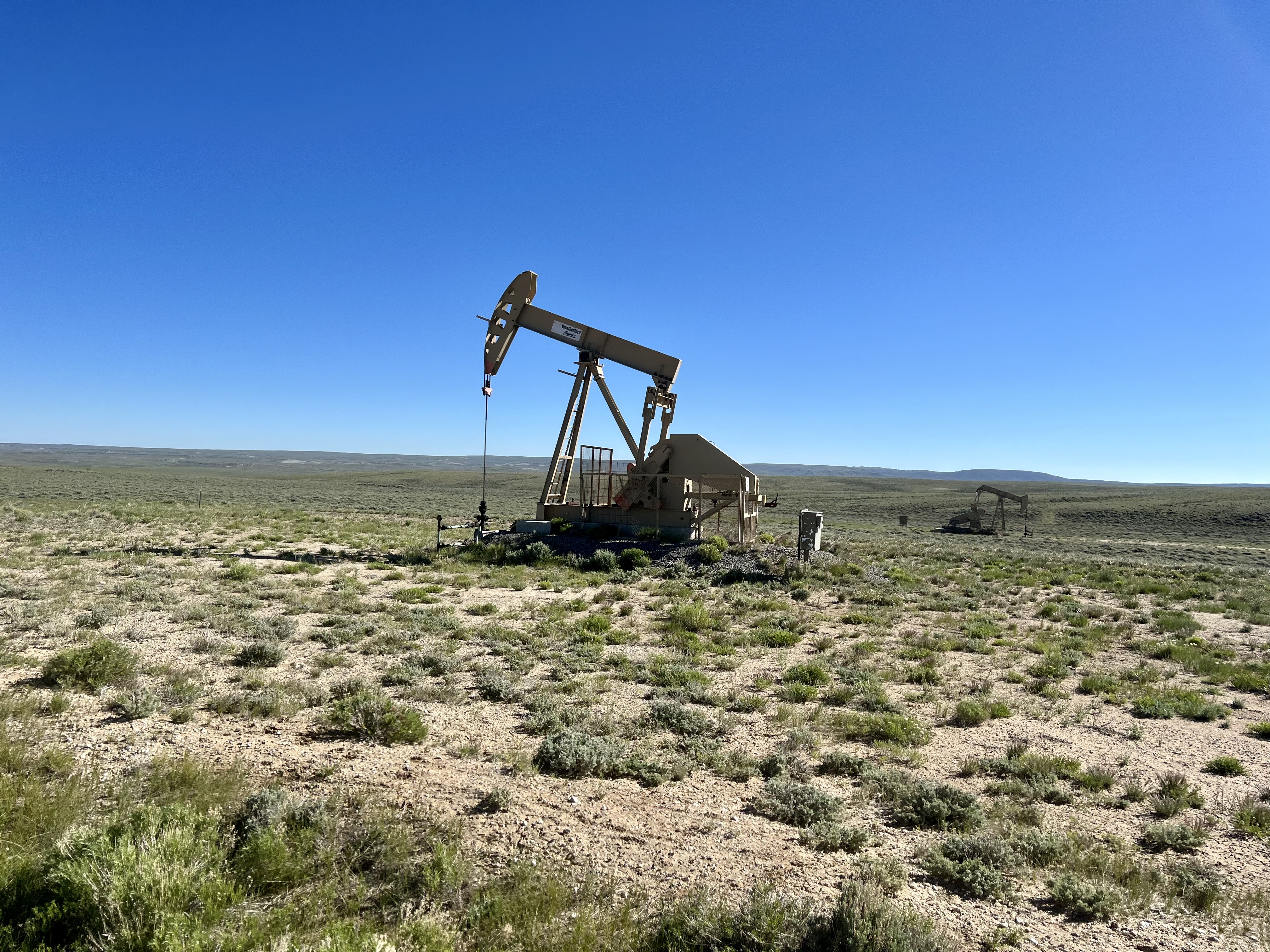
I came to a T and continued straight. I was still on road 2317, also no known as Three Forks – Atlantic City Road. It was 8:42 AM and I had ridden seventeen miles. I noticed oil jacks and tanks down in Buffalo Basin. The jacks were active. I then passed the Bison Basin Oil Field Camp to my right. I think they should rename these camps Cancer Basin Oil Field and Sludge Basin Oil Field.
I continued and rode straight through the middle of the Sludge Basin Oil Field. There were warning signs and it smelled toxic. I then zig zagged my way on the dirt through the sage brush prairie. My gear shifters had been giving me trouble, and haven't been cooperating for several days, particularly when upshifting. My Surly Shimano system uses levers and it’s basic. On my Salsa SRAM system I single click to go up and double click to go down. It’s currently not wanting to click up. My chain should have been cleaned days ago, and I should be cleaning it every night. I would be bringing my bike to a shop soon.
I saw dozens of pronghorn today. Why do the prairie dogs dig their tunnels directly into the road service? Is the dirt softer? Their entrances were certainly more exposed to birds of prey. Entering and exiting from the middle of the road was risky. By 10:30 AM I had ridden thirty miles, and I was completely out of water. I had twenty-five miles to go.
A water source was indicated on my paper map. I stopped and searched around until I located Diagnus well, which had been set up in cooperation and funding between the Livestock Producers of the Green Mountain Common Allotment, the Wyoming Game and Fish Department, the Water for Wildlife Foundation, the North American Pronghorn Foundation, and the Bureau of Land Management. I was psyched and filtered two liters of cold precious water.
I stripped down to my bare feet, cycling shorts, and short sleeve shirt. I lathered myself with sunscreen and put on my arm covers. It was remarkable how drastic the weather had changed.
As forecast, the wind was coming from the south. As the day progressed it got stronger. I was getting closer to the Wind River Range with the sun and wind on my back. I would be going around the south side of the range this time. Last time on the Trans Am I went around the north side. There were crazy washboards stretching for miles. I passed the first motor vehicle that I’d seen since yesterday afternoon when I stopped for my cured meat and taco snack.
I crossed over Harris Slough and noticed water. I then crossed over Long Slough and saw no water. Next I crossed over the Sweetwater River which was forty feet wide and three feet deep with brown flowing current. I was ten miles out from Atlantic City and it was 1:15 PM. It was all uphill getting into town. A few motor vehicles passed me going both directions.
I was climbing and getting closer, and saw no signs of a town, which was strange. I got to the top of a pass and could see the town down below in the valley ahead. I went straight to Miner’s Grubstake where I began ordering pints of Hot Streak IPA from Sheridan WY. I ordered two buffalo burgers with fries and two slices of strawberry rhubarb pie a la mode. I edited this report as I sat at the table. A local bicycle hostel wanted $65 for a cabin, and I decided to ride seven miles out of town for a free camping spot.
 |
| Waning Gibbous moon over Cow Camp |
 |
| Wild camping near Cow Camp Spring, WY |
 |
| The Great Basin |


 |
| Cancer Basin Oil Field |
 |
| Sludge Basin Oil Field |
 |
| Sludge Basin Oil Field |
 |
| Cushion Orophaca |
 |
| Pale Evening Primrose |
 |
| Globemallow |
 |
| Fleabane |
 |
| Bitterroot |
 |
| Cushion Buckwheat |
 |
| Diagnus well |
 |
| Filtering water |

 |
| Map/Elevation Profile |


Comments
Post a Comment